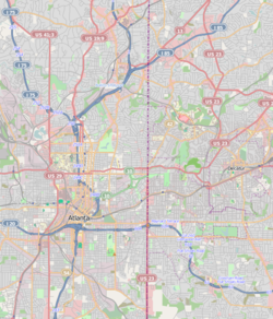
North Druid Hills, Georgia
| North Druid Hills, Georgia | |
|---|---|
| Community and Census-designated place (CDP) | |
|
Toco Hills Shopping Center
|
|
 Location in DeKalb County and the state of Georgia |
|
| location within central Metro Atlanta | |
| Coordinates: 33°49′11″N 84°19′41″W / 33.81972°N 84.32806°WCoordinates: 33°49′11″N 84°19′41″W / 33.81972°N 84.32806°W | |
| Country | United States |
| State | Georgia |
| County | DeKalb |
| Area | |
| • Total | 5 sq mi (12.9 km2) |
| • Land | 5 sq mi (12.9 km2) |
| • Water | 0 sq mi (0 km2) |
| Elevation | 1,014 ft (309 m) |
| Population (2010) | |
| • Total | 18,947 |
| • Density | 3,800/sq mi (1,500/km2) |
| Time zone | Eastern (EST) (UTC-5) |
| • Summer (DST) | EDT (UTC-4) |
| FIPS code | 13-56168 |
| GNIS feature ID | 1805271 |
North Druid Hills, also known as Briarcliff, is an unincorporated community and census-designated place (North Druid Hills CDP) in DeKalb County, Georgia, United States. The population was 18,947 at the 2010 census. The center of the area is the intersection of Briarcliff and North Druid Hills Roads.
North Druid Hills is located at 33°49′11″N 84°19′41″W / 33.819654°N 84.328061°W.
According to the United States Census Bureau, the CDP has a total area of 5.0 square miles (13 km2), of which 0.20% is water. The CDP boundaries are:
Toco Hills is a large commercial and residential neighborhood in the eastern portion of the North Druid Hills CDP. The commercial component consists of two major shopping centers that are located at the intersection of LaVista and North Druid Hills roads that were developed in the 1950s. While it is generally accepted that the name "Toco Hills" is derived from the Toco Hill shopping center, the origin of that name is disputed. Some sources claim that the developer chose the name Toco because it was the Brazilian Indian word for "good luck." Other sources claim Toco is an informal abbreviation of "top of the County." In any case, the shopping center was developed on what was a hill, and the name gradually changed to "Toco Hills." The area is home to a large Orthodox Jewish population, and marked by wooded subdivisions featuring mostly ranch homes surrounding the commercial area.
As of the census of 2000, there were 18,852 people, 9,760 households, and 3,074 families residing in the CDP. Population density was 3,790.0 people per square mile (1,464.5/km²). There were 10,240 housing units at an average density of 2,058.7/sq mi (795.5/km²). CDP ethnic makeup was 82.50% White, 7.30% African American, 0.15% Native American, 4.32% Hispanic or Latino (any race), 6.73% Asian, 0.03% Pacific Islander, 1.44% from other races, and 1.85% from two or more races.
...
Wikipedia

