Ocean Pines, Maryland
| Ocean Pines, Maryland | |
|---|---|
| CDP | |
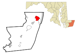
 Location In Worcester County and the state of Maryland |
|
| Location within the state of Maryland | |
| Coordinates: 38°23′1″N 75°9′10″W / 38.38361°N 75.15278°WCoordinates: 38°23′1″N 75°9′10″W / 38.38361°N 75.15278°W | |
| Country | United States |
| State | Maryland |
| County | Worcester |
| Government | |
| • Type | Homeowners' association |
| • President, Board of Directors | Pat Renaud |
| • General Manager | Bob Thompson |
| Area | |
| • Total | 9.4 sq mi (24.1 km2) |
| • Land | 6.7 sq mi (17.2 km2) |
| • Water | 2.7 sq mi (7.0 km2) |
| Elevation | 10 ft (3 m) |
| Population (2010) | |
| • Total | 11,710 |
| • Density | 1,758.5/sq mi (679.0/km2) |
| Time zone | Eastern (EST) (UTC-5) |
| • Summer (DST) | EDT (UTC-4) |
| ZIP code | 21811 |
| Area code(s) | 410, 443 |
| FIPS code | 24-58275 |
| GNIS feature ID | 0590933 |
| Website | http://www.oceanpines.org |
Ocean Pines is a census-designated place (CDP) in Worcester County, Maryland, United States. The population was 11,710 at the 2010 census. It is part of the Salisbury, Maryland-Delaware Metropolitan Statistical Area. It shares the same ZIP code as Berlin, Maryland, which is considered the town center.
In 1984, Gerald S Klien bought $55 million in property for development using Merritt Commercial Savings and Loan assets including a $2 million Maryland Marine wastewater plant. Maple Lawn and Burleigh developer partner Stuart Greenbaum, purchased 800 additional acres for subdivision. In 1985 Worcester County commissioners condemned the Maryland Marine Systems Merritt Commercial Savings and Loan owned sewer system embroiled in the Jeffery Levitt Scandal in order to remove a development moratorium. The system had failed to implement $1.3 million in required maintenance to prevent sewer overflow into the streets creating the moratorium.
Ocean Pines is located at 38°23′1″N 75°9′10″W / 38.38361°N 75.15278°W (38.383692, -75.152755).
According to the United States Census Bureau, the CDP has a total area of 9.4 square miles (24 km2), of which 6.7 square miles (17 km2) is land and 2.7 square miles (7.0 km2) (29.0%) is water.
...
Wikipedia


