Orocovis, Puerto Rico
| Orocovis, Puerto Rico | ||
|---|---|---|
| Municipality | ||
|
||
| Nickname(s): "Corazón de Puerto Rico", "El Centro Geográfico de Puerto Rico" | ||
| Anthem: "Mi patria es una bella isla" | ||
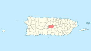
 Location of Orocovis in Puerto Rico |
||
| Coordinates: 18°13′37″N 66°23′28″W / 18.22694°N 66.39111°WCoordinates: 18°13′37″N 66°23′28″W / 18.22694°N 66.39111°W | ||
| Country | United States | |
| Territory | Puerto Rico | |
| Founded | November 10, 1825 | |
| Government | ||
| • Mayor | Hon. Jesús E. Colón Berlingeri (PNP) | |
| • Senatorial dist. | 5 - Ponce | |
| • Representative dist. | 26 | |
| Area | ||
| • Total | 71.1 sq mi (184.17 km2) | |
| • Land | 71.0 sq mi (184 km2) | |
| • Water | 0.1 sq mi (0.17 km2) | |
| Population (2010) | ||
| • Total | 23,423 | |
| • Density | 330/sq mi (130/km2) | |
| Demonym(s) | Orocoveños | |
| Time zone | AST (UTC-4) | |
| Zip code | 00720 | |
Orocovis (from Taino language, Orocobix meaning remembrance of the first mountain) is a municipality of Puerto Rico located in the Central Mountain Range, north of Villalba and Coamo; south of Morovis and Corozal; southeast of Ciales; east of Jayuya; and west of Barranquitas. Orocovis is spread over 17 wards and Orocovis Pueblo (the downtown area and the administrative center of the city). It is part of the San Juan-Caguas-Guaynabo Metropolitan Statistical Area.
Since before the Spanish colonization in the 16th century, Taíno Indians were already established in the Orocovis region. They were led by the cacique Orocobix and his group of Taino was known as the Jatibonicu. After Spaniards settled in the island, the region was called Barros and designated as a barrio of Barranquitas.
On May 25, 1825, the neighbors of the region granted Don Juan de Rivera Santiago the powers to request the Governor authorization to found a municipality in Barros, where they had bought almost 14 acres of land from Doña Eulalia de Rivera, who donated an additional acre to establish several municipal works. However, due to the distance from bodies of water, the settlement was moved to another place. On November 10, 1825, Governor Miguel de la Torre granted permission to found the new municipality of Barros.
...
Wikipedia

