Ozark, Missouri
| Ozark, Missouri | |
|---|---|
| City | |
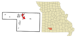
 Location of Ozark, Missouri |
|
| Coordinates: 37°1′38″N 93°12′34″W / 37.02722°N 93.20944°WCoordinates: 37°1′38″N 93°12′34″W / 37.02722°N 93.20944°W | |
| Country | United States |
| State | Missouri |
| County | Christian |
| Area | |
| • Total | 11.15 sq mi (28.88 km2) |
| • Land | 11.10 sq mi (28.75 km2) |
| • Water | 0.05 sq mi (0.13 km2) |
| Elevation | 1,168 ft (356 m) |
| Population (2010) | |
| • Total | 17,820 |
| • Estimate (2015) | 19,120 |
| • Density | 1,605.4/sq mi (619.8/km2) |
| Time zone | Central (CST) (UTC-6) |
| • Summer (DST) | CDT (UTC-5) |
| ZIP code | 65721 |
| Area code(s) | 417 |
| FIPS code | 29-55766 |
| GNIS feature ID | 0723933 |
| Website | Official website |
Ozark, incorporated in 1890, is a city in Christian County, Missouri, United States. The population was 17,820 at the 2010 census. As of 2015, the population was 19,120. (Census Bureau Estimate) It is the county seat of Christian County. Ozark is part of the Springfield, Missouri Metropolitan Area, and is centered along a business loop of U.S. Route 65, where it intersects with Missouri Route 14. It is south of Springfield and north of Branson.
Ozark was named from the Ozarks, in which it is situated.
The Ozark Courthouse Square Historic District was listed on the National Register of Historic Places in 2009.
Ozark is located at 37°1′38″N 93°12′34″W / 37.02722°N 93.20944°W (37.027111, −93.209572). According to the United States Census Bureau, the city has a total area of 11.15 square miles (28.88 km2), of which, 11.10 square miles (28.75 km2) is land and 0.05 square miles (0.13 km2) is water.
...
Wikipedia
