Pantin
| Pantin | ||
|---|---|---|

The town hall of Pantin
|
||
|
||
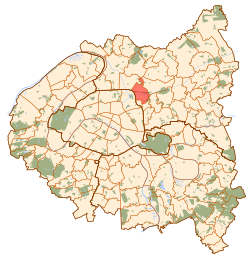
 Paris and inner ring departments |
||
| Coordinates: 48°53′48″N 2°24′06″E / 48.8966°N 2.4017°ECoordinates: 48°53′48″N 2°24′06″E / 48.8966°N 2.4017°E | ||
| Country | France | |
| Region | Île-de-France | |
| Department | Seine-Saint-Denis | |
| Arrondissement | Bobigny | |
| Canton | Pantin | |
| Intercommunality | Communauté d'agglomération Est Ensemble | |
| Government | ||
| • Mayor (2014–2020) | Bertrand Kern | |
| Area1 | 5.01 km2 (1.93 sq mi) | |
| Population (2010)2 | 54,136 | |
| • Density | 11,000/km2 (28,000/sq mi) | |
| Time zone | CET (UTC+1) | |
| • Summer (DST) | CEST (UTC+2) | |
| INSEE/Postal code | 93055 / 93500 | |
| Elevation | 38–108 m (125–354 ft) | |
|
1 French Land Register data, which excludes lakes, ponds, glaciers > 1 km² (0.386 sq mi or 247 acres) and river estuaries. 2Population without double counting: residents of multiple communes (e.g., students and military personnel) only counted once. |
||
1 French Land Register data, which excludes lakes, ponds, glaciers > 1 km² (0.386 sq mi or 247 acres) and river estuaries.
Pantin (French pronunciation: [pɑ̃.tɛ̃]) is a commune in the northeastern suburbs of Paris, France. It is located 6.4 km (4.0 mi) from the centre of Paris. It is one of the most densely populated municipalities in Europe. Its post code is 93500. The city is located on the edge of Paris and is mainly formed by a plain crossed by national roadway 2 and 3, the railway line Paris–Strasbourg and Ourcq canal.
Pantin borders the Paris inner ring road (périphérique) and is traversed by national routes N2 and N3, as well as the Paris-Strasbourg railway line and the Ourcq canal.
The name Pantin was recorded for the first time in 1067 as Pentini, perhaps from the Roman patronym Pentinus, a variant of Pantaenus or Repentinus, but this etymology is not certain.
On 1 January 1860, the city of Paris was enlarged by annexing neighbouring communes. On that occasion, a small part of the commune of Pantin was annexed to Paris.
On 24 July 1867, a part of the territory of Pantin was detached and merged with a part of the territory of Romainville and a part of the territory of Bagnolet to create the commune of Les Lilas.
By 1875, the Ourcq canal and new railway lines served to divide the town into two parts—the "Village" and the "Quatre Chemins".
The recent construction of a science park along the Bassin de la Villette on the former site of city abattoirs has improved pedestrian access to Paris, as well as encouraging urban regeneration in Pantin itself. A key policy discussed since the 2008 mayoral election has been the possibility of integrating the ten banlieue towns of Bagnolet, Les Lilas, Le Pré-Saint-Gervais, Romainville, Pantin, Noisy-le-Sec, Montreuil, Bobigny, Bondy and Rosny-sous-Bois into an "intercommune" of around 440,000 people. This new municipality could be created as early as January 2010. This project was implemented, it gathers nine communes. In 2016, Pantin was declared France's most polluted town by the World Health Organization.
...
Wikipedia

