Perth, Indiana
| Perth | |
|---|---|
| Unincorporated community | |
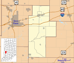
| Location in Clay County | |
| Coordinates: 39°35′35″N 87°09′43″W / 39.59306°N 87.16194°WCoordinates: 39°35′35″N 87°09′43″W / 39.59306°N 87.16194°W | |
| Country | United States |
| State | Indiana |
| County | Clay |
| Township | Dick Johnson |
| Elevation | 630 ft (190 m) |
| ZIP code | 47837 |
| FIPS code | 18-59310 |
| GNIS feature ID | 441045 |
Perth is an unincorporated community in Dick Johnson Township, Clay County, Indiana. It is part of the Terre Haute Metropolitan Statistical Area.
Perth is located at 39°35′35″N 87°09′43″W / 39.59306°N 87.16194°W.
Perth had its start in the year 1870 by the building of the railroad through that territory. It was named after Perth, Scotland. A post office was established at Perth in 1880, and remained in operation until it was discontinued in 1929.
...
Wikipedia

