Pflugerville, Texas
| Pflugerville, Texas | |
|---|---|
| City | |

Pflugerville City Hall
|
|
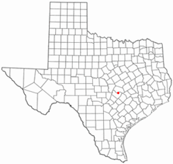
 Location of Pflugerville, Texas |
|
 |
|
| Coordinates: 30°26′46″N 97°37′26″W / 30.44611°N 97.62389°WCoordinates: 30°26′46″N 97°37′26″W / 30.44611°N 97.62389°W | |
| Country |
|
| State |
|
| Counties | Travis, Williamson |
| Government | |
| • Type | Council-Manager |
| • City Council |
Mayor Jeff Coleman Wayne Cooper Brad Marshall Omar Pena Starlet Sattler Mike Heath |
| • City Manager | Brandon Wade |
| Area | |
| • Land | 22.3 sq mi (58 km2) |
| Elevation | 719 ft (219 m) |
| Population (2010) | |
| • Total | 46,936 |
| • Density | 2,102.8/sq mi (812.0/km2) |
| Time zone | Central (CST) (UTC-6) |
| • Summer (DST) | CDT (UTC-5) |
| ZIP codes | 78660, 78691 |
| Area code(s) | 512 & 737 |
| FIPS code | 48-57176 |
| GNIS feature ID | 1365131 |
| Website | PflugervilleTX.gov |
Pflugerville /ˈfluːɡərvɪl/ is a city in Travis County, Texas with a small portion in Williamson County. The population was 46,936 at the 2010 census. Pflugerville is a suburb of Austin and part of the Austin–Round Rock–San Marcos Metropolitan Statistical Area.
Pflugerville is located at 30°26′46″N 97°37′26″W / 30.446122°N 97.623989°W (30.446122, -97.623989), 14 miles (23 km) northeast of downtown Austin along FM 1825 (Pecan Street) in northern Travis County. Pflugerville is situated 15 miles (24 km) northeast of the Colorado River.
According to the 2010 United States Census Bureau, the city has a total land area of 22.32 square miles. And Pflugerville has 40.39 square miles in the extraterritorial jurisdiction. The city has one body of water - Lake Pflugerville - created in 2005 to serve as a water reservoir and recreation area, and two creeks, Gilleland Creek and Wilbarger Creek. A local school group Wilbarger Water Watchers in association with the LCRA monitor the waters of Wilbarger Creek to ensure it meets the United States Environmental Protection Agency's national standard.
...
Wikipedia
