Phan Rang Air Base
| Phan Rang Air Base | |
|---|---|
| Part of Vietnam People's Air Force (VPAF) South Vietnamese Air Force (VNAF) Pacific Air Forces (USAF) |
|

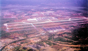
Phan Rang Air Base, South Vietnam 1967
|
|
| Coordinates | 11°38′06″N 108°57′01″E / 11.63500°N 108.95028°E |
| Type | Air Force Base |
| Site information | |
| Controlled by |
|
| Condition | Seized 1975 by PAVN, in use as military airfield |
| Site history | |
| Built | 1942 (rebuilt 1965) |
| In use | 1942–1954; 1965–present |
| Battles/wars |
Vietnam War |
| Garrison information | |
| Garrison |
|
| Airfield information | |||||||||||||||||||
|---|---|---|---|---|---|---|---|---|---|---|---|---|---|---|---|---|---|---|---|
| Summary | |||||||||||||||||||
| Elevation AMSL | 32 m / 105 ft | ||||||||||||||||||
| Coordinates | 11°38′01″N 108°57′07″E / 11.63361°N 108.95194°ECoordinates: 11°38′01″N 108°57′07″E / 11.63361°N 108.95194°E | ||||||||||||||||||
| Map | |||||||||||||||||||
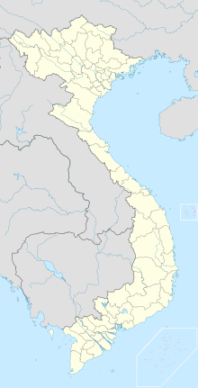
| Location of the airport in Vietnam | |||||||||||||||||||
| Runways | |||||||||||||||||||
|
|||||||||||||||||||
![]() Vietnam People's Air Force
Vietnam People's Air Force![]() South Vietnamese Air Force
South Vietnamese Air Force

92d Tactical Wing (SVNAF)

366th Tactical Fighter Wing (USAF)
35th Tactical Fighter Wing (USAF)
315th Tactical Airlift Wing (USAF)
...
Wikipedia


