Piz Bernina
| Piz Bernina | |
|---|---|

Piz Bernina with the Biancograt to the right
|
|
| Highest point | |
| Elevation | 4,048.6 m (13,283 ft) |
| Prominence | 2,234 m (7,329 ft) Ranked 5th in the Alps |
| Isolation | 138 km (86 mi) |
| Parent peak | Mont Blanc |
| Listing |
Canton high point Ultra |
| Coordinates | 46°22′56.42″N 9°54′29.02″E / 46.3823389°N 9.9080611°ECoordinates: 46°22′56.42″N 9°54′29.02″E / 46.3823389°N 9.9080611°E |
| Geography | |
| Location |
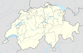
Graubünden, Switzerland (massif partially in Italy) |
| Parent range | Bernina |
| Topo map | Swisstopo 1277 Piz Bernina |
| Climbing | |
| First ascent | 13 September 1850 by Johann Coaz guided by Jon and Lorenz Ragut Tscharner |
| Easiest route | rock/ice climb |
Piz Bernina (4,048.6 m (13,283 ft)) is the highest mountain in the Eastern Alps, the highest point of the Bernina Range, and the highest peak in the Rhaetian Alps. It is also the most easterly mountain higher than 4,000 m (13,000 ft) in the Alps, the highest point of the Swiss canton of Graubünden, and the fifth-most prominent peak in the Alps. Piz Bernina is located south of Pontresina and near the major Alpine resort of St. Moritz, in the Engadin valley.
The mountain was named after the Bernina Pass in 1850 by Johann Coaz, who also made the first ascent. The prefix Piz comes from the Romansch language in Graubünden; any mountain with that name can be readily identified as being located in southeastern Switzerland.
Piz Bernina is one of the few isolated Alpine four-thousanders and the most topographically isolated mountain of Switzerland. It is the culminating point of a group of summits slightly lower than 4,000 meters (13,120 feet) mostly lying on the main watershed between Switzerland and Italy (such as Piz Scerscen, Piz Zupò, and Piz Palü). The only other summit higher than 4,000 m (13,000 ft) is La Spedla (the Shoulder), a minor prominence south of the mountain, which is also the highest point on the Italian side of the massif.
...
Wikipedia

