Piz Lunghin
| Piz Lunghin | |
|---|---|

Lake Sils and Piz Lunghin (centre right)
|
|
| Highest point | |
| Elevation | 2,780 m (9,120 ft) |
| Prominence | 135 m (443 ft) |
| Parent peak | Piz Lagrev |
| Listing | List of mountains of Switzerland |
| Coordinates | 46°24′38″N 9°40′13″E / 46.41056°N 9.67028°ECoordinates: 46°24′38″N 9°40′13″E / 46.41056°N 9.67028°E |
| Geography | |
| Parent range | Albula Range |
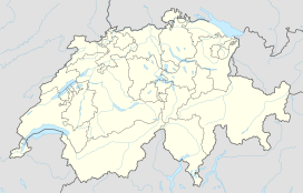
Piz Lunghin (2,780 m) is a mountain in the Swiss canton of Graubünden, located in the Albula range, overlooking the Maloja Pass. It can be considered as the "roof of Europe" as the water running off the mountain can head towards the Atlantic, Mediterranean or Black Sea.
Piz Lunghin lies at the upper end of the Engadine (east) and the Bregaglia (west) valleys. The Maloja Pass, which connects the two valleys, is located 2 km south-east from the peak. The north side of the mountain lies in the protected area Parc Ela.
The notable triple watershed is in fact located 600 metres from the summit itself, at the Lunghin Pass, at 2645 m (46°24′48.70″N 9°39′49.20″E / 46.4135278°N 9.6636667°E). The north-west side gives birth to a river ending in the Gelgia, a tributary of the Albula, itself a tributary of the Rhine. From the south-west side the water flows towards the Mera in Val Bregaglia, a tributary of the Po. Finally the Inn originates from Lägh dal Lunghin below the peak, east to the pass. The Inn is a tributary of the Danube.
...
Wikipedia

