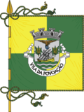
Povoação Municipality
| Povoação | |||
| Municipality (Concelho) | |||
|
The municipal seat of the municipality of Povoação located along the lombas of the Povoação crater
|
|||
|
|||
| Official name: Concelho da Povoação | |||
| Name origin: povoação, Portuguese for population or settled by peoples | |||
| Country | |||
|---|---|---|---|
| Autonomous Region | |||
| Island | São Miguel | ||
| Civil Parishes | Água Retorta, Faial da Terra, Furnas, Nossa Senhora dos Remédios, Povoação, Ribeira Quente | ||
| Center | Pico do Buraco | ||
| - elevation | 580 m (1,903 ft) | ||
| - coordinates | 37°46′43″N 25°16′45″W / 37.77861°N 25.27917°WCoordinates: 37°46′43″N 25°16′45″W / 37.77861°N 25.27917°W | ||
| Highest point | Pico da Vara | ||
| - location | Planalto dos Graminhais | ||
| - elevation | 1,019 m (3,343 ft) | ||
| - coordinates | 37°48′32″N 25°12′48″W / 37.80889°N 25.21333°W | ||
| Lowest point | Sea level | ||
| - location | Atlantic Ocean | ||
| - elevation | 0 m (0 ft) | ||
| Area | 106.41 km2 (41 sq mi) | ||
| - water | 1.94 km2 (1 sq mi) | ||
| - urban | 2.71 km2 (1 sq mi) | ||
| Population | 6,327 (2011) | ||
| Density | 59/km2 (153/sq mi) | ||
| Settlement | c. 1472 | ||
| - Municipality | c. 1839 | ||
| LAU | Câmara Municipal | ||
| - location | Largo do Municipio | ||
| - elevation | 7 m (23 ft) | ||
| - coordinates | 37°44′48″N 25°14′45″W / 37.74667°N 25.24583°W | ||
| President | Carlos Emílio Lopes Machado Ávila (PS) | ||
| Municipal Chair | Benilde Oliveira (PS) | ||
| Timezone | Azores (UTC-1) | ||
| - summer (DST) | Azores (UTC0) | ||
| Postal Zone | 9650-411 | ||
| Area Code & Prefix | (+351) 296 XX XX XX | ||
| Demonym | Povoacense | ||
| Patron Saint | Nossa Senhora da Mãe de Deus | ||
| Municipal Holidays | 3 July; the day after Corpus Christi | ||
|
Location of the municipality of Povoação in the archipelago of the Azores
|
|||
| Statistics: Instituto Nacional de Estatística | |||
| Website: http://www.cm-povoacao.pt | |||
| Geographic detail from CAOP (2010) produced by Instituto Geográfico Português (IGP) | |||
Povoação (Portuguese pronunciation: [puvuɐˈsɐ̃w]) is a municipality located in the southeastern corner of the island of São Miguel in the Portuguese archipelago of the Azores. The population in 2011 was 6,327, in an area of 106.41 km².
Colonization of the island is commonly associated with the settlement of Povoação Velha, the first colony on the island of São Miguel. In 1427, Diogo Dilva first arrived in the area of Povoação, accompanied by several men: "Arriving here on the island, the nine discoverers took land in the place where today we call Povoação Velha for which they made later...and, disembarked between two fresh ravines of clear, sweet and cold waters, (the Ribeira de Além and the Ribeira de Pelames) between the cliffs and high lands, (Morro de Santa Bárbara and Lomba dos Pós) all covered in greenery of cedro, laurel, ginger and faias, and other diverse". From the beginning, the locality impressed the settlers, since it was abundant in vegetation, to them indicating a fertile land.
In 1432, Gonçalo Velho Cabral, then first Captain-Donatário of São Miguel, chose the locality for the first settlement on the island. From this location they began to transport cattle, wheat seed, legumes and agricultural implements in order to make the settlement viable. On 2 July 1439, a royal decree from Infante D. Pedro, regent to King Afonso V, ordered Infante Henry to send sheep to the seven islands of the Azores (until that time Corves and Flores had not been discovered).
During the 18th century, the region became a center of naval construction, owing to the abundance of wood in the immediate area.
The community of Povoação was elevated to the status of municipality in 1839, when it was de-annexed from the municipality of Vila Franca do Campo and later, Nordeste. The parish church, dedicated to Nossa Senhora da Mãe de Deus (Our Lady The Mother of God), was constructed from 24 July 1848, and emblematic for is gilded wood alterpeices and the image of its patron. On 4 July 1865 the parish council building was first inaugurated, later to be the site of the municipalities local government.
The municipality, and in particular the town of Povoação, was damaged during the 1935 earthquake. Construction on the municipal garden began in the 1940s, during the execution of the reconstruction program for the urban nucleus.
...
Wikipedia


