Powhatan County, Virginia
| Powhatan County, Virginia | ||
|---|---|---|

Powhatan County Courthouse
|
||
|
||
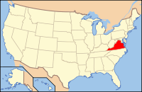
 Location in the U.S. state of Virginia |
||
 Virginia's location in the U.S. |
||
| Founded | 1777 | |
| Seat | Powhatan | |
| Area | ||
| • Total | 262 sq mi (679 km2) | |
| • Land | 260 sq mi (673 km2) | |
| • Water | 2.1 sq mi (5 km2), 0.8% | |
| Population (est.) | ||
| • (2015) | 28,031 | |
| • Density | 85/sq mi (33/km²) | |
| Congressional district | 4th | |
| Time zone | Eastern: UTC-5/-4 | |
| Website | www |
|
Powhatan County (/ˈpaʊ.həˈtæn/) is a county located in the Commonwealth of Virginia. As of the 2010 census, the population was 28,046. Its county seat is Powhatan.
Powhatan County is included in the Greater Richmond Region.
The James River forms the county's northern border, and the Appomattox River is on the south side. The county is named for the paramount chief of the powerful confederacy of tribes of Algonquian-speaking Native Americans in the Tidewater in 1607, when the British settled at Jamestown. Historically this Piedmont area had been occupied by the Siouan-speaking Monacan, who moved west under pressure from colonists. In 1700 French Huguenot refugees settled at their abandoned village, known as Manakin Town, which was located above the falls on the James River.
See Native American tribes in Virginia
...
Wikipedia

