Prince Edward County, Virginia
| Prince Edward County, Virginia | ||
|---|---|---|
|
||
 Location in the U.S. state of Virginia |
||
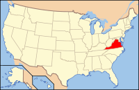
 Virginia's location in the U.S. |
||
| Founded | 1754 | |
| Named for | Prince Edward, Duke of York and Albany | |
| Seat | Farmville | |
| Largest town | Farmville | |
| Area | ||
| • Total | 354 sq mi (917 km2) | |
| • Land | 350 sq mi (906 km2) | |
| • Water | 3.9 sq mi (10 km2), 1.1% | |
| Population (est.) | ||
| • (2015) | 23,368 | |
| • Density | 66/sq mi (25/km²) | |
| Congressional district | 5th | |
| Time zone | Eastern: UTC-5/-4 | |
| Website | www |
|
Prince Edward County is a county located in the Commonwealth of Virginia. As of the 2010 census, the population was 23,368. Its county seat is Farmville.
Prince Edward County, Virginia was formed in the Virginia Colony in 1754 from Amelia County. It was named for Prince Edward, second son of Frederick, Prince of Wales and younger brother of George III of the United Kingdom.
The original county seat housed the courthouse and was called Prince Edward Courthouse; it is now the village of Worsham.
Near the headwaters of the Appomattox River, the Town of Farmville was formed in 1798, and was incorporated in 1912. The county seat was moved from Worsham to Farmville in 1871.
In the 1850s, the Southside Railroad between Petersburg and Lynchburg was built through Farmville between Burkeville and Pamplin City. The route, which was subsidized by a contribution from Farmville, required an expensive crossing of the Appomattox River slightly downstream which became known as the High Bridge.
The Southside Railroad was heavily damaged during the American Civil War. The High Bridge played a key role during Confederate General Robert E. Lee's final retreat from Petersburg to Appomattox Courthouse, where the surrender to Union General Ulysses S. Grant took place in April, 1865.
...
Wikipedia

