Purcellville, Virginia
| Purcellville, Virginia | |
|---|---|
| Town | |
| Town of Purcellville | |

Downtown Purcellville in November 2014
|
|
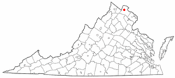
 Location of Purcellville, Virginia |
|
| Coordinates: 39°8′4″N 77°42′40″W / 39.13444°N 77.71111°WCoordinates: 39°8′4″N 77°42′40″W / 39.13444°N 77.71111°W | |
| Country | |
| State |
|
| County |
|
| Incorporated | March 14, 1908 |
| Government | |
| • Mayor | Kwasi Fraser |
| Area | |
| • Total | 3.1 sq mi (8 km2) |
| • Land | 3.1 sq mi (8 km2) |
| • Water | 0.0 sq mi (0 km2) |
| Elevation | 574 ft (175 m) |
| Population (2010) | |
| • Total | 7,727 |
| • Density | 1,512.2/sq mi (583.9/km2) |
| Time zone | Eastern (EST) (UTC-5) |
| • Summer (DST) | EDT (UTC-4) |
| ZIP codes | 20132, 20134, 20160 |
| Area code(s) | 540 |
| FIPS code | 51-65008 |
| GNIS feature ID | 1472871 |
| Website | PurcellvilleVA.com |
Purcellville is a town in Loudoun County, Virginia, United States. The population was 9,232 according to the United States Census 2015 Population Estimate (as of July 1, 2015). Purcellville is the major population center for western Loudoun and the Loudoun Valley. Today[update], many of the older structures remaining in Purcellville reflect the Victorian architecture popular during the early 20th century. Patrick Henry College is located in the town.
Although the first land grant in the area was issued by Lord Fairfax in 1740, it was not until 1764 that Purcellville's first known settler, James Dillon from Bucks County, Pennsylvania, arrived. The early ox cart track which wound westward from Leesburg towards the Blue Ridge, known later as the "Great Road," served as the town's nucleus, although farms existed in the area, and had been founded nearby by 1752. The first recorded business, an ordinary (a combined store and inn), was established by Abraham Vickers in 1799. This was followed by a second ordinary, established by Stacey Taylor in 1804, and later by "Purcel's Store" and Post Office, established by Valentine Vernon Purcell (from whom the town's name is derived). A blacksmith's shop, established around 1848, was also among the Purcellville's earliest businesses. On July 9, 1853 the village officially adopted the name Purcellville
The Great Road became an authorized turnpike in 1785 and extended the turnpike system westward from Alexandria to Snickers Gap, and beyond to Berryville and Winchester. With the construction of this Turnpike in 1832, travel through Purcellville began to increase and the first stagecoach arrived in 1841. A railroad on link on the Alexandria, Loudoun and Hampshire line (forerunner to the Washington and Old Dominion Railroad) connecting the town to Leesburg and points east was built prior to the Civil War, and travel to points further west were continued by stagecoach through Purcellville.
Although both Union and Confederate armies passed through Purcellville during the Civil War, the town witnessed limited fighting with the most notable action occurring at the skirmish of Heaton's Crossroads. The town and surrounding area were contained within the area known as Mosby's Confederacy, the main area of operations for Confederate partisan John S. Mosby, and the town was pillaged as part of The Burning Raid of 1864 in retribution for the area's support of Mosby's command.
...
Wikipedia
