Quinton, New Jersey
| Quinton Township, New Jersey | |
|---|---|
| Township | |
| Township of Quinton | |

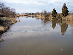
Alloway Creek
|
|
 Quinton Township highlighted in Salem County. Inset map: Salem County highlighted in the State of New Jersey. |
|
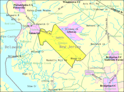
 Census Bureau map of Quinton Township, New Jersey |
|
| Coordinates: 39°31′46″N 75°23′32″W / 39.529355°N 75.392243°WCoordinates: 39°31′46″N 75°23′32″W / 39.529355°N 75.392243°W | |
| Country | |
| State |
|
| County | Salem |
| Incorporated | February 18, 1873 |
| Government | |
| • Type | Township |
| • Body | Township Committee |
| • Mayor | Raymond Owens (R, term ends December 31, 2015) |
| • Clerk | Marty R. Uzdanovics |
| Area | |
| • Total | 24.578 sq mi (63.656 km2) |
| • Land | 24.092 sq mi (62.397 km2) |
| • Water | 0.486 sq mi (1.260 km2) 1.98% |
| Area rank | 111th of 566 in state 8th of 15 in county |
| Elevation | 69 ft (21 m) |
| Population (2010 Census) | |
| • Total | 2,666 |
| • Estimate (2015) | 2,569 |
| • Rank | 464th of 566 in state 10th of 15 in county |
| • Density | 110.7/sq mi (42.7/km2) |
| • Density rank | 537th of 566 in state 9th of 15 in county |
| Time zone | Eastern (EST) (UTC-5) |
| • Summer (DST) | Eastern (EDT) (UTC-4) |
| ZIP code | 08072 |
| Area code(s) | 856 |
| FIPS code | 3403361470 |
| GNIS feature ID | 0882130 |
| Website | www |
Quinton Township is a township in Salem County, in the U.S. state of New Jersey. As of the 2010 United States Census, the township's population was 2,666, reflecting a decline of 120 (-4.3%) from the 2,786 counted in the 2000 Census, which had in turn increased by 275 (+11.0%) from the 2,511 counted in the 1990 Census.
Quinton was formally incorporated as a township by an act of the New Jersey Legislature on February 18, 1873, from portions of Upper Alloways Creek Township (now Alloway Township). The township's name is said to derive from the name of an early settler, with both Tobias Quinton and Edward Quinton mentioned as possible namesakes.
It is a dry township, where alcohol cannot be sold.
According to the United States Census Bureau, the township had a total area of 24.578 square miles (63.656 km2), including 24.092 square miles (62.397 km2) of land and 0.486 square miles (1.260 km2) of water (1.98%).
Quinton CDP (with a 2010 Census population of 588) is an unincorporated community and census-designated place (CDP) located within Quinton Township.
Unincorporated communities located partially or completely within the township Berrys Chapel, Harmony, Mickles Mill, Pecks Corner, Woodmere and Woods Upper Mill.
The township borders the Salem County municipalities of Alloway Township, Lower Alloways Creek Township, Mannington Township and Salem. Quinton Township also borders Cumberland County.
...
Wikipedia
