Różan
| Różan | ||
|---|---|---|

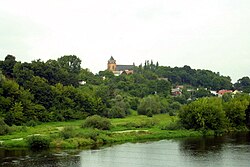
View with Narew river
|
||
|
||
| Coordinates: 52°53′25″N 21°23′45″E / 52.89028°N 21.39583°ECoordinates: 52°53′25″N 21°23′45″E / 52.89028°N 21.39583°E | ||
| Country |
|
|
| Voivodeship | Masovian | |
| County | Maków | |
| Gmina | Różan | |
| Town rights | 1378 | |
| Government | ||
| • Mayor | Jerzy Kazimierz Parciński | |
| Area | ||
| • Total | 6.67 km2 (2.58 sq mi) | |
| Population (2006) | ||
| • Total | 2,661 | |
| • Density | 400/km2 (1,000/sq mi) | |
| Time zone | CET (UTC+1) | |
| • Summer (DST) | CEST (UTC+2) | |
| Postal code | 06-230 | |
| Area code(s) | +48 29 | |
| Car plates | WMA | |
| Website | www.rozan.eur.pl | |
Różan [ˈruʐan] is a town in Mazovian Voivodeship, Poland, on the river Narew. National roads 60 and 61 intersect in the town.
In the late Middle Ages, Rozan emerged as an important trade center of northeastern Mazovia. Enjoying support of Mazovian Dukes, especially Janusz I of Warsaw, in 1378 it received town charter, a became a capital of a separate province, the Land of Rozan. In 1525, Mazovia was annexed by the Kingdom of Poland, and Rozan became seat of a starosta, part of Masovian Voivodeship (1526–1795). In 1565, the town had 330 houses and population of app. 2000. It also probably had as many as 6 churches, and a castle, which guarded nearby border with Prussia. Furthermore, there was a bridge over the Narew, which fortified the importance of Rozan as a trade and administrative center.
The town prospered until the disastrous Swedish invasion of Poland (1655 - 1660), when it was ransacked and burned by the invaders. Following the Partitions of Poland and the Congress of Vienna, Rozan in 1815 became part of Russian-controlled Congress Poland, where it remained until World War One. After the January Uprising, which was widely supported by local residents, in 1870 Russians stripped Rozan of its town charter. Nevertheless, Rozan was a strong garrison of the Imperial Russian Army, with four forts, built after 1886.
...
Wikipedia


