Radium, Kansas
| Radium, Kansas | |
|---|---|
| City | |
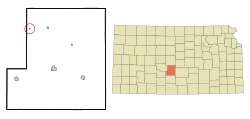
 Location within Stafford County and Kansas |
|
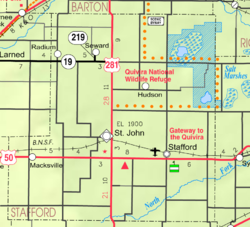
 KDOT map of Stafford County (legend) |
|
| Coordinates: 38°10′25″N 98°53′39″W / 38.17361°N 98.89417°WCoordinates: 38°10′25″N 98°53′39″W / 38.17361°N 98.89417°W | |
| Country | United States |
| State | Kansas |
| County | Stafford |
| Government | |
| • Type | Mayor–Council |
| Area | |
| • Total | 0.04 sq mi (0.10 km2) |
| • Land | 0.04 sq mi (0.10 km2) |
| • Water | 0 sq mi (0 km2) |
| Elevation | 1,952 ft (595 m) |
| Population (2010) | |
| • Total | 25 |
| • Estimate (2016) | 24 |
| • Density | 630/sq mi (250/km2) |
| Time zone | Central (CST) (UTC-6) |
| • Summer (DST) | CDT (UTC-5) |
| ZIP code | 67550 |
| Area code | 620 |
| FIPS code | 20-58300 |
| GNIS feature ID | 0475866 |
Radium is a city in Stafford County, Kansas, United States. As of the 2010 census, the city population was 25.
A post office was opened in Radium in 1910, and remained in operation until it was discontinued in 1990.
Radium is located at 38°10′25″N 98°53′39″W / 38.17361°N 98.89417°W (38.173698, -98.894222). According to the United States Census Bureau, the city has a total area of 0.04 square miles (0.10 km2), all of it land.
As of the census of 2010, there were 25 people, 15 households, and 7 families residing in the city. The population density was 625.0 inhabitants per square mile (241.3/km2). There were 19 housing units at an average density of 475.0 per square mile (183.4/km2). The racial makeup of the city was 96.0% White and 4.0% from two or more races.
There were 15 households of which 13.3% had children under the age of 18 living with them, 46.7% were married couples living together, and 53.3% were non-families. 53.3% of all households were made up of individuals. The average household size was 1.67 and the average family size was 2.29.
The median age in the city was 53.2 years. 12% of residents were under the age of 18; 8% were between the ages of 18 and 24; 16% were from 25 to 44; 56% were from 45 to 64; and 8% were 65 years of age or older. The gender makeup of the city was 56.0% male and 44.0% female.
As of the census of 2000, there were 40 people, 17 households, and 9 families residing in the city. The population density was 965.2 people per square mile (386.1/km²). There were 19 housing units at an average density of 458.5 per square mile (183.4/km²). The racial makeup of the city was 95.00% White, and 5.00% from two or more races. Hispanic or Latino of any race were 5.00% of the population.
...
Wikipedia
