Range Regional Airport
| Range Regional Airport | |||||||||||||||
|---|---|---|---|---|---|---|---|---|---|---|---|---|---|---|---|
 |
|||||||||||||||
| Summary | |||||||||||||||
| Airport type | Public | ||||||||||||||
| Owner | Chisholm-Hibbing Airport | ||||||||||||||
| Serves | Hibbing, Minnesota | ||||||||||||||
| Elevation AMSL | 1,354 ft / 413 m | ||||||||||||||
| Coordinates | 47°23′12″N 092°50′20″W / 47.38667°N 92.83889°WCoordinates: 47°23′12″N 092°50′20″W / 47.38667°N 92.83889°W | ||||||||||||||
| Website | RangeRegionalAirport.com | ||||||||||||||
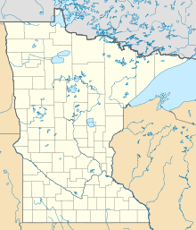
| Map | |||||||||||||||
| Location of airport in Minnesota / United States | |||||||||||||||
| Runways | |||||||||||||||
|
|||||||||||||||
| Statistics | |||||||||||||||
|
|||||||||||||||
|
Source: Federal Aviation Administration
|
|||||||||||||||
| Aircraft operations (2014) | 30,365 |
|---|---|
| Based aircraft (2017) | 43 |
Range Regional Airport (IATA: HIB, ICAO: KHIB, FAA LID: HIB) is a public use airport located four nautical miles (5 mi, 7 km) southeast of the central business district of Hibbing, in Saint Louis County, Minnesota, United States. It was formerly known as Chisholm-Hibbing Airport or Chisholm-Hibbing Municipal Airport. The airport is mostly used for general aviation but is also served by one commercial and one charter airline. Scheduled passenger service is subsidized by the Essential Air Service program.
As per Federal Aviation Administration records, the airport had 8,896 passenger boardings (enplanements) in calendar year 2008, 8,926 enplanements in 2009, and 11,227 in 2010. It is included in the National Plan of Integrated Airport Systems for 2011–2015, which categorized it as a non-primary commercial service airport based on 2008 enplanements (between 2,500 and 10,000), but would be considered primary commercial service based on enplanements in 2010.
Range Regional Airport covers an area of 1,600 acres (647 ha) at an elevation of 1,354 feet (413 m) above mean sea level. It has two runways with asphalt surfaces: 13/31 is 6,758 by 150 feet (2,060 x 46 m) and 4/22 is 3,075 by 75 feet (937 x 23 m).
...
Wikipedia


