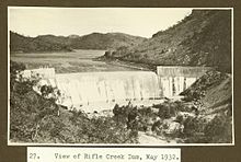
Rifle Creek Dam
| Rifle Creek Dam | |
|---|---|

The dam in 1932
|
|
| Country | Australia |
| Location | 28 km (17 mi) south-east of Mount Isa, Queensland |
| Coordinates | 20°57′27″S 139°35′24″E / 20.9574°S 139.59°ECoordinates: 20°57′27″S 139°35′24″E / 20.9574°S 139.59°E |
| Reservoir | |
| Total capacity | 9,488 megalitres (7,692 acre·ft) |
Rifle Creek Dam is owned by Mount Isa Mines. With the completion of the East Leichhardt Dam in 1958, Rifle Creek Dam water was completely available for use by the mine.
...
Wikipedia
