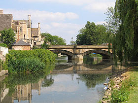
River Welland
| River Welland |
|
The river at Stamford
|
| Country |
United Kingdom |
| Country within the UK |
England |
| Counties |
Northamptonshire, Leicestershire, Rutland, Lincolnshire
|
| Towns |
Market Harborough, Stamford, Crowland, Spalding
|
|
| Tributaries |
| - left |
Eye Brook, River Chater, River Gwash, River Glen
|
| - right |
River Jordan |
|
|
| Source |
|
| - location |
Hothorpe Hills, Sibbertoft, Northamptonshire
|
| - elevation |
157 m (515 ft) |
| - coordinates |
52°26′24″N 1°00′35″W / 52.4399°N 1.0098°W / 52.4399; -1.0098 |
| Mouth |
Fosdyke Wash |
| - location |
The Wash, Lincolnshire
|
| - elevation |
1 m (3 ft) |
| - coordinates |
52°53′54″N 0°01′51″E / 52.8983°N 0.0308°E / 52.8983; 0.0308Coordinates: 52°53′54″N 0°01′51″E / 52.8983°N 0.0308°E / 52.8983; 0.0308 |
|
| Length |
105 km (65 mi) |
| Basin |
1,580 km2 (610 sq mi) |
| Discharge |
for Tallington
|
| - average |
3.7 m3/s (131 cu ft/s)
|
| - max |
94.5 m3/s (3,337 cu ft/s)
|
|
| |
|
| Progression : Welland — The Wash — North Sea
|
|
River Welland
|
|
|
|
The Wash |
|
|
|
Holbeach River |
|
|
|
A17 Fosdyke bridge |
|
|
|
Five Towns Drain + Pumping Station |
|
|
|
Risegate Eau |
|
|
|
River Glen |
|
|
|
Vernatt's Drain |
|
|
|
Vernatt's Bridge Sluice |
|
|
|
River Welland |
|
|
|
A16 bridge |
|
|
|
Coronation Channel |
|
|
|
Fulney Lock, Marsh Road sluice |
|
|
|
A151 Holbeach Road bridge |
|
|
|
Spalding |
|
|
|
Cowbit Road sluice |
|
|
|
New River |
|
|
|
A16 bridges |
|
|
|
Cowbit wash |
|
|
|
Crowland Fodder Lots |
|
|
|
B1166 Crowland
|
|
|
|
Former channel to South Ea |
|
|
|
Crowland High Wash |
|
|
|
Folly River(limit of navigation)
|
|
|
|
Old course and Maxey Cut |
|
| |

