Rocksprings, Texas
| Rocksprings, Texas | |
|---|---|
| City | |

Historic Rocksprings Hotel
|
|
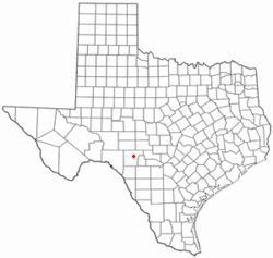
 Location of Rocksprings, Texas |
|
 |
|
| Coordinates: 30°0′58″N 100°12′32″W / 30.01611°N 100.20889°WCoordinates: 30°0′58″N 100°12′32″W / 30.01611°N 100.20889°W | |
| Country | United States |
| State | Texas |
| County | Edwards |
| Area | |
| • Total | 1.22 sq mi (3.15 km2) |
| • Land | 1.22 sq mi (3.15 km2) |
| • Water | 0.0 sq mi (0.0 km2) |
| Elevation | 2,402 ft (732 m) |
| Population (2010) | |
| • Total | 1,182 |
| • Density | 973/sq mi (375.5/km2) |
| Time zone | Central (CST) (UTC-6) |
| • Summer (DST) | CDT (UTC-5) |
| ZIP code | 78880 |
| Area code(s) | 830 |
| FIPS code | 48-62816 |
| GNIS feature ID | 1345423 |
Rocksprings is a town in Edwards County, Texas, in the United States. As of the 2010 census, the town population was 1,182, down from 1,285 at the 2000 census. It is the county seat of Edwards County. The town received its name from natural springs that bubble forth from the porous limestone rocks in the area.
J. R. Sweeten sited Rocksprings in 1891 because of the springs nearby. Also in 1891, the town acquired a post office and was made county seat. The original courthouse built in the town burned in 1897. By 1914 Rocksprings had a population of around 500.
On April 12, 1927, the town was hit by an F5 tornado that destroyed 235 of the 247 buildings in the town. The tornado killed 72 townspeople and injured 205, almost 1/3 of the population at the time.
Rocksprings is located northeast of the center of Edwards County at 30°0′58″N 100°12′32″W / 30.01611°N 100.20889°W (30.016161, -100.209023). Rocksprings sits on top of the Edwards Plateau. According to the United States Census Bureau, the town has a total area of 1.2 square miles (3.1 km2), all of it land.
U.S. Route 377 passes through the center of the town, leading northeast 46 miles (74 km) to Junction and southwest 76 miles (122 km) to Del Rio. Texas State Highway 55 joins US 377 as Main Street through Rocksprings, but leads northwest 55 miles (89 km) to Sonora and south 68 miles (109 km) to Uvalde.
...
Wikipedia
