Rutherglen, Glasgow
Rutherglen
|
|
|---|---|
 Main Street, the main shopping area of Rutherglen. |
|
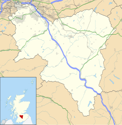
| Rutherglen shown within South Lanarkshire | |
| Population | 25,000 |
| OS grid reference | NS614616 |
| Council area | |
| Lieutenancy area | |
| Country | Scotland |
| Sovereign state | United Kingdom |
| Post town | GLASGOW |
| Postcode district | G73 |
| Dialling code | 0141 |
| Police | Scottish |
| Fire | Scottish |
| Ambulance | Scottish |
| EU Parliament | Scotland |
| UK Parliament | |
| Scottish Parliament | |
Rutherglen (Scots: Ruglen) is a town in South Lanarkshire, Scotland. Having existed as a Lanarkshire burgh in its own right for over 800 years, in 1975 it lost its own local council and administratively became a component of the City of Glasgow District Council within the Strathclyde region (along with neighbouring Cambuslang). In 1996 Rutherglen was reallocated to the South Lanarkshire council area.
Rutherglen received the status of Royal Burgh in 1126 by Royal Charter from King David I of Scotland who ruled from 1124 to 1153. In the 14th century Walter Stewart, father of King Robert II, was granted Farme Castle. This was located close to Farme Cross in the east of Rutherglen, and stood until the 1960s.
Rutherglen was a centre of heavy industry, having a long coal mining tradition which died out by 1950. J&J White's Chemical Works (later ACC Chrome & Chemicals) in Shawfield, which was in existence from 1820 to 1967, produced more than 70% of the UK's Chromate products including chromic acid, chromic oxide pigment, sodium and potassium chromate and dichromate. Today there is a significant legacy of soluble chromium (VI) waste in the area. Rutherglen, and most of the other towns encircling the city, are dormitory suburbs of Glasgow.
...
Wikipedia

