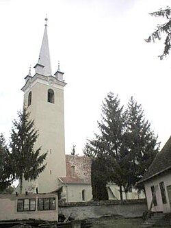
Sărățeni, Mureș
|
Sărățeni Sóvárad |
|
|---|---|
| Commune | |
 |
|
| Location of Sărăteni | |
| Coordinates: 46°33′44.4″N 25°0′32.1″E / 46.562333°N 25.008917°ECoordinates: 46°33′44.4″N 25°0′32.1″E / 46.562333°N 25.008917°E | |
| Country |
|
| County | Mureș County |
| Status | Commune |
| Government | |
| • Mayor | Árpád Madaras (Democratic Union of Hungarians in Romania) |
| Population (2002) | |
| • Total | See Sovata |
| Time zone | EET (UTC+2) |
| • Summer (DST) | EEST (UTC+3) |
Sărățeni (Hungarian: Sóvárad, Hungarian pronunciation: [ˈʃoːvaːrɒd]) is a commune in Mureș County, Romania. It became an independent commune when it split from the town of Sovata in 2004. The commune, composed of a single village, Sărățeni, has an absolute Székely Hungarian majority. For demographics see Sovata.
It is the location of Castra of Sărățeni, a Roman fort.
...
Wikipedia

