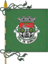
Sabrosa Municipality
| Sabrosa | |||
|---|---|---|---|
| Municipality | |||
|
|||
 |
|||
| Coordinates: 41°17′4″N 7°35′42″W / 41.28444°N 7.59500°WCoordinates: 41°17′4″N 7°35′42″W / 41.28444°N 7.59500°W | |||
| Country |
|
||
| Region | Norte | ||
| Subregion | Douro | ||
| Intermunic. comm. | Douro | ||
| District | Vila Real | ||
| Parishes | 12 | ||
| Government | |||
| • President | José Manuel de Carvalho Marques (PS) | ||
| Area | |||
| • Total | 156.92 km2 (60.59 sq mi) | ||
| Elevation | 544 m (1,785 ft) | ||
| Population (2011) | |||
| • Total | 6,361 | ||
| • Density | 41/km2 (100/sq mi) | ||
| Time zone | WET/WEST (UTC+0/+1) | ||
| Postal code | 5060 | ||
| Area code | 259 | ||
| Website | http://www.cm-sabrosa.pt | ||
Sabrosa (Portuguese pronunciation: [sɐˈβɾɔzɐ]) is a municipality in the district of Vila Real in northern Portugal. The population in 2011 was 6,361, in an area of 156.92 km².
Although the municipality was established on 6 November 1836, the history of the region extends back to vestiges from different tribes and groups that lived in area, remoting to the pre-historic period. During this period ancient Neolithic tribes constructed dolmen funerary structures, such as the Mamoa 1 de Madorras in the Serra da Padrela (Arcã), a monumental, yet well-preserved tomb.
Also, the Castro culture of the Iron Age resulted in many of these stone fortifications scattered throughout the municipality; castros like the Castro of Sancha, Castelo dos Mouros or Castro de São Domingos de Provesende, are located in sights of good visibility and natural defences, reinforced by the construction of moats and walls. The Castro of Sabrosa was actually adopted by the Romans, who left behind coins and a stone inscription dedicated to Jupiter. A Luso-Roman cemetery was also discovered in the parish of Provesende (in Quinta da Relva), and classified as a patrimony of public interest, but it was destroyed in the 1950s when the land was re-purposed for vineyards.
The majority of the settlements in Sabrosa date back to the Middle Ages, and were formalized in forals bestowed by hereditary heirs of Afonso I of Portugal. Many of these settlements were actually established prior to 1143 (the establishment of the Kingdom of Portugal), such as Provesende, and have scattered paleo-Christian structures from this period, as in the cases of Arcã, Vilar de Celas, Paredes, Provesende and Donelo.
After the 15th century, records from the region began to become more detailed, identifying the residence of noblemen in the region, including the House of Pereira, where Ferdinand Magellan (Portuguese: Fernão Magalhães) was born. The life of these families were associated with the construction family estates distributed throughout the municipality. The prosperity of the region was due in part to the growth of Demarcated Region of the Douro, and through the exploitation by the Companhia Geral da Agricultura das Vinhas do Alto Douro, which was established by the Marquess of Pombal in 1756. By establishing a special wine region designation for the Douro region, he elevated the importance of the area, creating incentives to improve the production of Douro wines and improve quality exports. With the exception of Parada do Pinhão, São Lourenço de Ribapinhão and Torre do Pinhão all the parishes of Sabrosa fell within the demarcated region.
...
Wikipedia


