Sainte-Marie-aux-Mines
| Sainte-Marie-aux-Mines | ||
|---|---|---|

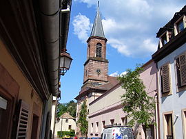
Saint-Louis church
|
||
|
||
| Coordinates: 48°15′N 7°11′E / 48.25°N 7.18°ECoordinates: 48°15′N 7°11′E / 48.25°N 7.18°E | ||
| Country | France | |
| Region | Grand Est | |
| Department | Haut-Rhin | |
| Arrondissement | Colmar-Ribeauvillé | |
| Canton | Sainte-Marie-aux-Mines | |
| Intercommunality | Val d'Argent | |
| Government | ||
| • Mayor (2001–2008) | Claude Abel | |
| Area1 | 45.23 km2 (17.46 sq mi) | |
| Population (2006)2 | 5,749 | |
| • Density | 130/km2 (330/sq mi) | |
| Time zone | CET (UTC+1) | |
| • Summer (DST) | CEST (UTC+2) | |
| INSEE/Postal code | 68298 /68160 | |
| Elevation | 326–1,210 m (1,070–3,970 ft) (avg. 375 m or 1,230 ft) |
|
|
1 French Land Register data, which excludes lakes, ponds, glaciers > 1 km² (0.386 sq mi or 247 acres) and river estuaries. 2Population without double counting: residents of multiple communes (e.g., students and military personnel) only counted once. |
||
1 French Land Register data, which excludes lakes, ponds, glaciers > 1 km² (0.386 sq mi or 247 acres) and river estuaries.
Sainte-Marie-aux-Mines (German: Markirch) is a commune in the Haut-Rhin department in Grand Est in northeastern France.
Sainte Marie-aux-Mines is located in the massif of the Vosges Mountains, where it occupies the V-shaped valley of the Lièpvrette River. Nearby Lorraine is accessible by road over the Col de Sainte-Marie (772 m) or the Tunnel Maurice-Lemaire (reopened, following a major upgrade, in October 2008). The Col des Bagenelles (903 m) leads to the Col du Bonhomme and to the Route des Crêtes (Road of the Ridges).
The Col du Haut de Ribeauvillé (742 m, 2,412 feet) gives direct access to Ribeauvillé, situated 20 km (12 mi) to the southeast. Sélestat in the Bas Rhin, a much more substantial commercial and political focus for the region, is just 26 km (16 mi) to the east, along the Liepvrette valley.
Sainte Marie-aux-Mines is surrounded on both sides of the valley by high mountains. The Lièpvrette River, which was formerly called Landbach, separates the city into two parts, and, formerly, into two different parishes.
Some 23 km to the west lies Sélestat at the crossroads of Highway 59 and the D 48, which crosses the Col des Bagenelles.
Early Latin documents called the town Fanum S. Mariae or S. Maria ad Fodinas. It was called in German Markirch or Mariakirch. After Alsace was retaken from the Germans in year II of the Republic, it was called Val-aux-Mines.
...
Wikipedia


