Sandyston Township, Sussex County, New Jersey
| Sandyston Township, New Jersey | |
|---|---|
| Township | |
| Township of Sandyston | |

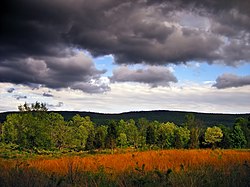
Autumn landscape
|
|
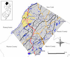
 Map of Sandyston Township in Sussex County. Inset: Location of Sussex County highlighted in the State of New Jersey. |
|
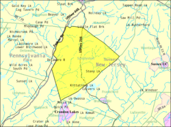
 Census Bureau map of Sandyston Township, New Jersey |
|
| Coordinates: 41°12′49″N 74°48′49″W / 41.2136°N 74.813514°WCoordinates: 41°12′49″N 74°48′49″W / 41.2136°N 74.813514°W | |
| Country |
|
| State |
|
| County | Sussex |
| Royal charter | February 26, 1762 |
| Incorporated | February 21, 1798 |
| Government | |
| • Type | Township |
| • Body | Township Committee |
| • Mayor | Frederick V. MacDonald (R, term ends December 31, 2018) |
| • Municipal clerk | Amanda Lobban |
| Area | |
| • Total | 43.259 sq mi (112.040 km2) |
| • Land | 42.519 sq mi (110.124 km2) |
| • Water | 0.740 sq mi (1.917 km2) 1.71% |
| Area rank | 46th of 566 in state 4th of 24 in county |
| Elevation | 692 ft (211 m) |
| Population (2010 Census) | |
| • Total | 1,998 |
| • Estimate (2016) | 1,877 |
| • Rank | 486th of 566 in state 21st of 24 in county |
| • Density | 47.0/sq mi (18.1/km2) |
| • Density rank | 555th of 566 in state 23rd of 24 in county |
| Time zone | Eastern (EST) (UTC-5) |
| • Summer (DST) | Eastern (EDT) (UTC-4) |
| ZIP code | 07826 - Branchville |
| Area code(s) | 973 |
| FIPS code | 3403765700 |
| GNIS feature ID | 0882255 |
| Website | www |
Sandyston Township is a small rural township in Sussex County, New Jersey, United States, located in the northwestern part of the state near the Pennsylvania border. The township is surrounded by and part of many national and state parks. As of the 2010 United States Census, the township's population was 1,998, reflecting an increase of 173 (+9.5%) from the 1,825 counted in the 2000 Census, which had in turn increased by 93 (+5.4%) from the 1,732 counted in the 1990 Census. Sandyston's growth in recent years has been attributed to the influx of people from more urban parts of the state and even New York City, located less than 75 miles (121 km) away.
New Jersey Monthly magazine ranked Sandyston Township as its 26th best place to live in its 2008 rankings of the "Best Places To Live" in New Jersey.
Sandyston was first formed by Royal charter on February 26, 1762, from portions of Walpack Township. Sandyston was incorporated as a township on February 21, 1798, by an act of the New Jersey Legislature as part of the initial group of 104 townships incorporated in the state.
According to the United States Census Bureau, the township had a total area of 43.259 square miles (112.040 km2), including 42.519 square miles (110.124 km2) of land and 0.740 square miles (1.917 km2) of water (1.71%).
The township ranges from 300 to 1,600 feet (91 to 488 m) above sea level. A ridge runs along the eastern half of the township called the Kittatinny Mountains. The highest point in the township is Sunrise Mountain in Stokes State Forest. The lowest point is around the Delaware River in the western half of the township.
...
Wikipedia
