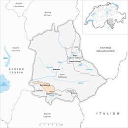
Sant'Antonino, Switzerland
| Sant'Antonino | ||
|---|---|---|

Sant'Antonino street
|
||
|
||
| Coordinates: 46°09′N 8°59′E / 46.150°N 8.983°ECoordinates: 46°09′N 8°59′E / 46.150°N 8.983°E | ||
| Country | Switzerland | |
| Canton | Ticino | |
| District | Bellinzona | |
| Government | ||
| • Mayor | Sindaco | |
| Area | ||
| • Total | 6.59 km2 (2.54 sq mi) | |
| Elevation | 226 m (741 ft) | |
| Population (Dec 2015) | ||
| • Total | 2,411 | |
| • Density | 370/km2 (950/sq mi) | |
| Postal code | 6592 | |
| SFOS number | 5017 | |
| Surrounded by | Cadenazzo, Camorino, Giubiasco, Gudo, Isone | |
| Website |
www SFSO statistics |
|
For Sant'Antonino in France, see Sant'Antonino, Haute-Corse. Not to be confused with the municipality of Sant'Antonio in the same district.
Sant'Antonino is a municipality in the district of Bellinzona in the canton of Ticino in Switzerland.
Sant'Antonino is first mentioned in 1219 as Sancto Antorino. In the al Sasso area, some late-Roman graves were discovered. During the Middle Ages, the Church of S. Pietro in Bellinzona (early 13th century), the hospital in Contone (1337) and the cathedral of Como (1397) all owned land in Sant'Antonino. Until 1442, it was part of the Bellinzona parish. Then it formed a parish with Cadenazzo, which remained until it dissolved in 1830. The first church in the village is mentioned in 1291. It was rebuilt in the 16th and 17th Centuries, in the Baroque style.
The local economy was dominated by livestock farming and agriculture. By the end of the 19th Century, reclamation of land along the Magadino river allowed additional agricultural land. Beginning in the 1960s and 70s, it grew into a residential community, due to it close proximity to Bellinzona. At the beginning of the 21st Century, the municipality was home to a growing number of commercial and industrial enterprises.
Sant'Antonino has an area, as of 1997[update], of 6.59 square kilometers (2.54 sq mi). Of this area, 2.85 km2 (1.10 sq mi) or 43.2% is used for agricultural purposes, while 2.92 km2 (1.13 sq mi) or 44.3% is forested. Of the rest of the land, 1.11 km2 (0.43 sq mi) or 16.8% is settled (buildings or roads), 0.12 km2 (30 acres) or 1.8% is either rivers or lakes and 0.04 km2 (9.9 acres) or 0.6% is unproductive land.
...
Wikipedia


