Schimmelkopf
| Schimmelkopf (Weiskircher Höhe) |
|
|---|---|
|
|
|
| Highest point | |
| Elevation | 694.8 m above sea level (NHN) (2,280 ft) |
| Coordinates | 49°35′21″N 6°48′21″E / 49.589278°N 6.805833°ECoordinates: 49°35′21″N 6°48′21″E / 49.589278°N 6.805833°E |
| Geography | |
| Location | near Weiskirchen; Saarland, Rhineland-Palatinate, Germany |
| Parent range | Schwarzwalder Hochwald |
The Schimmelkopf or Weiskircher Höhe is a mountain that rises in the Schwarzwalder Hochwald (part of the Hunsrück) on the boundary between the counties of Trier-Saarburg (Rhineland-Palatinate) and Merzig-Wadern (Saarland) and, at 694.8 m above sea level (NHN), is the second highest peak in the German state of Saarland.
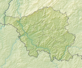
The Schimmelkopf rises in the southwestern part of the Schwarzwalder Hochwald along the northern state border of the Saarland. Its summit lies within the Saar-Hunsrück Nature Park, about 4.8 km north of Weiskirchen (Saarland), around 3.7 km southeast of Mandern and circa 3.3 km south of Waldweiler (both in Rhineland-Palatinate).
...
Wikipedia

