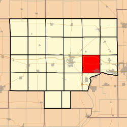
Selby Township, Bureau County, Illinois
| Selby Township | |
|---|---|
| Township | |
 Location in Bureau County |
|
 Bureau County's location in Illinois |
|
| Coordinates: 41°21′45″N 89°19′53″W / 41.36250°N 89.33139°WCoordinates: 41°21′45″N 89°19′53″W / 41.36250°N 89.33139°W | |
| Country | United States |
| State | Illinois |
| County | Bureau |
| Established | November 6, 1849 |
| Area | |
| • Total | 36.15 sq mi (93.6 km2) |
| • Land | 35.94 sq mi (93.1 km2) |
| • Water | 0.21 sq mi (0.5 km2) 0.58% |
| Elevation | 659 ft (201 m) |
| Population (2010) | |
| • Total | 2,536 |
| • Density | 70.6/sq mi (27.3/km2) |
| Time zone | CST (UTC-6) |
| • Summer (DST) | CDT (UTC-5) |
| ZIP codes | 61322, 61356, 61359, 61362 |
| GNIS feature ID | 0429727 |
Selby Township is one of twenty-five townships in Bureau County, Illinois, USA. As of the 2010 census, its population was 2,536 and it contained 971 housing units.
According to the 2010 census, the township has a total area of 36.15 square miles (93.6 km2), of which 35.94 square miles (93.1 km2) (or 99.42%) is land and 0.21 square miles (0.54 km2) (or 0.58%) is water.
(This list is based on USGS data and may include former settlements.)
The township contains these six cemeteries: Artestian Well, De Pue Village, Evangelical and Reformed, Hollowayville, Saint Johns Lutheran and Searl Ridge.
...
Wikipedia
