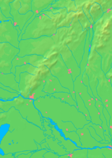
Skalica, Slovakia
| Skalica | ||
| Town | ||
|
City centre of Skalica
|
||
|
|
||
| Country | Slovakia | |
|---|---|---|
| Region | Trnava | |
| District | Skalica | |
| River | Morava | |
| Elevation | 186 m (610 ft) | |
| Coordinates | 48°50′32″N 17°13′36″E / 48.84222°N 17.22667°ECoordinates: 48°50′32″N 17°13′36″E / 48.84222°N 17.22667°E | |
| Area | 60.007 km2 (23 sq mi) | |
| Population | 14,963 (31 December 2005) | |
| Density | 249/km2 (645/sq mi) | |
| First mentioned | 1217 | |
| Mayor | Ľudovít Barát | |
| Timezone | CET (UTC+1) | |
| - summer (DST) | CEST (UTC+2) | |
| Postal code | 909 01 | |
| Phone prefix | 421-34 | |
| Car plate | SI | |
| Statistics: MOŠ/MIS | ||
| Website: http://www.skalica.sk | ||
Skalica (German: Skalitz, Hungarian: Szakolca, Latin: Sakolcium) is the largest town in Skalica District in western Slovakia in the Záhorie region. Located near the Czech border, Skalica has a population of 14,963 (as of 2005).
The name is derived from Slovak word skala (a rock) referring to the cliffs the inhabitants built their settlement over. The first written record of Skalica was made in 1217 as Skalza.
The site has been inhabited since 4000 BC and was part of the Great Moravian Empire. From the second half of the 10th century until 1918, it was part of the Kingdom of Hungary. The settlement developed around a triangular plaza, which was rare during the Middle Ages. Its town privileges were conferred in 1372 by King Louis I of Hungary. In 1428 Skalica became a bastion for the Hussites; during the Hussite Wars, the majority of its then predominantly German-speaking populace fled or was exiled. Many Habaners (adherents of a sect similar to Anabaptism) settled in Skalica in the 16th century.
On 6 November 1918 Skalica became the seat of the Temporary Government of Slovakia, for ten days de facto capital of Slovakia. The Temporary Government led by Vavro Šrobár declared here a sovereignty of the Czechoslovak state, published a newspaper Sloboda (Liberty) and unsuccessfully tried to negotiate the removal of Hungarian troops from Upper Hungary (today Slovakia).
...
Wikipedia


