Slieve Muck
| Slieve Muck | |
|---|---|
| Sliabh Muc | |

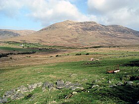
The southern slopes of Slieve Muck
|
|
| Highest point | |
| Elevation | 674 m (2,211 ft) |
| Prominence | 350 m (1,150 ft) |
| Listing | Marilyn, Hewitt |
| Geography | |
| Location | County Down, Northern Ireland |
| Parent range | Mourne Mountains |
| OSI/OSNI grid | J282250 |
| Topo map | OSNI Landranger 29, OSNI Outdoor Pursuits map Mourne Country |
Slieve Muck (/ˌsliːv ˈmʌk/ SLEEV MUK; from Irish: Sliabh Muc, meaning "pig mountain") is one of the Mourne Mountains in County Down, Northern Ireland. It has a height of 674 metres (2,211 ft). Its summit overlooks Spelga Dam and the Deer's Meadow, the source of the River Bann.
...
Wikipedia
