Somerset, Massachusetts
| Somerset, Massachusetts | ||
|---|---|---|
| Town | ||

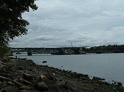
Brightman Street Bridge, taken from the Somerset side of the Taunton River
|
||
|
||
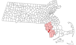
 Location in Bristol County in Massachusetts |
||
| Coordinates: 41°46′10″N 71°07′45″W / 41.76944°N 71.12917°WCoordinates: 41°46′10″N 71°07′45″W / 41.76944°N 71.12917°W | ||
| Country | United States | |
| State | Massachusetts | |
| County | Bristol | |
| Settled | 1677 | |
| Incorporated | 1790 | |
| Government | ||
| • Type | Open town meeting | |
| Area | ||
| • Total | 12.0 sq mi (31.0 km2) | |
| • Land | 8.1 sq mi (21.0 km2) | |
| • Water | 3.9 sq mi (10.0 km2) | |
| Elevation | 50 ft (15 m) | |
| Population (2010) | ||
| • Total | 18,165 | |
| • Density | 1,500/sq mi (590/km2) | |
| Time zone | Eastern (UTC-5) | |
| • Summer (DST) | Eastern (UTC-4) | |
| ZIP code | 02725, 02726 | |
| Area code(s) | 508 / 774 | |
| FIPS code | 25-62430 | |
| GNIS feature ID | 0619438 | |
| Website | http://www.townofsomerset.org/ | |
Somerset is a town in Bristol County, Massachusetts, United States. The population was 18,165 at the 2010 census. It is the birthplace and hometown of Clifford Milburn Holland (1883–1924), the chief engineer and namesake of the Holland Tunnel in New York City.
Somerset was first settled in 1677 on the Shawomet lands, and was officially incorporated in 1790. It was named for Somerset Square in Boston, which was, in turn, named for the county of Somerset in England. It was once a vital shipping point, and after the War of 1812 it was one of America's chief distribution points. In 1872, it became the site of a major coal port, and in the early 20th century a large cannery existed in the town. However, as neighboring Fall River's industry grew, it absorbed much of Somerset's, and the town took on more of a suburban character. In fact, the town's population grew during the Great Depression, as many people from Fall River and other localities moved to the suburb. Today, the town's major industry (other than suburban services) is power generation, with the Montaup Electric Company plant upriver (founded in 1923) and the Brayton Point Power Plant at the town's southern tip (founded in 1963). Brayton Point has been the target of much criticism for its pollution problems.
Historically, the town has had a connective relationship with Fall River. Originally, Slade's Ferry ran across the Taunton River to connect the two towns since the late 18th century. In the late 19th century, the Slade's Ferry Bridge connected the two towns, from the current southern terminus of Brayton Avenue in Somerset to Brownell Street in Fall River, and was double-decked, with a railroad section on the top level. The bridge was dismantled after closing in 1970 due to its rapid deterioration and its low height. (The path of the old bridge is still somewhat visible; two large sets of power lines cross the river at the same point.) The Brightman Street Bridge just to the north was opened in 1908. A new bridge, named the Veterans Memorial Bridge, was partially completed prior to a dedication ceremony held on September 11, 2011. At first, only the westbound side of the bridge was open to traffic. Since then, both lanes of the bridge have been opened for traffic.
...
Wikipedia

