Soomaa National Park
| Soomaa National Park (Soomaa rahvuspark) | |
| Protected area | |
|
The Raudna river
|
|
| Country | Estonia |
|---|---|
| County | Viljandi |
| Coordinates | 58°26′27″N 25°6′20″E / 58.44083°N 25.10556°ECoordinates: 58°26′27″N 25°6′20″E / 58.44083°N 25.10556°E |
| Area | 359 km2 (139 sq mi) |
| Established | 8 December 1993 |
| IUCN category | II - National Park |
|
Website: www |
|
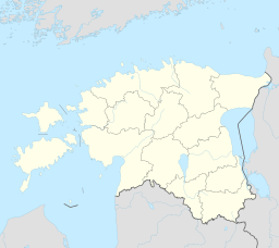
Soomaa National Park (Estonian: Soomaa rahvuspark) is national park in south-western Estonia. Soomaa ("land of bogs") protects 390 km², and is a Ramsar site of protected wetlands. The park was created in 1993.
The national park, situated in Transitional Estonia, has been created to protect large raised bogs, flood plain grasslands, paludified forests and meandering rivers. The territory of the national park is mostly covered with large mires, separated from each other by the rivers of the Pärnu River basin — the Navesti, Halliste, Raudna and Lemmjõgi rivers. Of the raised bogs, the most noteworthy is the Kuresoo raised bog, whose steep southern slope, falling into the Lemmejõgi, rises by 8 metres over a distance of 100 m.
On the eastern margin of the national park lie the highest dunes on the Estonian mainland, situated some 50 kilometres off the contemporary coastline. The most characteristic coastal formations of the predecessor of the present Baltic Sea, the Baltic Ice Lake (11 200–10,600 years ago), which marks the one-time water level, are situated on the north-western and western edges of the Sakala Upland. The Ruunaraipe Dunes are the highest of the area. The dune ridge, winding from northwest to southeast is a 1.2 km long sand ridge, whose maximum height is 12 metres.
In 2009, Soomaa National Park, the largest intact peat bog system in Europe preserved as wilderness, joined the PAN Parks network of wilderness areas as it proved excellence in combining wilderness protection and sustainable tourism development.
When vast amounts of water run down the Sakala Upland, the rivers of Soomaa cannot contain it all. The water flows over flood plain grasslands and forests, and covers roads, disrupting connection with the outer world. In some years the spring floods have risen by a meter a day for 3–4 days.
...
Wikipedia


