Southampton Township, Cumberland County, Pennsylvania
| Southampton Township, Cumberland County, Pennsylvania |
|
|---|---|
| Township | |

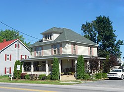
House in Lee's Cross Roads
|
|
 Map of Cumberland County, Pennsylvania highlighting Southampton Township |
|
 Map of Cumberland County, Pennsylvania |
|
| Country | United States |
| State | Pennsylvania |
| County | Cumberland |
| Government | |
| • Type | Board of Supervisors |
| Area | |
| • Total | 51.6 sq mi (133.6 km2) |
| • Land | 51.4 sq mi (133.2 km2) |
| • Water | 51.5 sq mi (133.4 km2) |
| Population (2010) | |
| • Total | 6,359 |
| • Estimate (2016) | 6,835 |
| • Density | 124/sq mi (47.7/km2) |
| Time zone | Eastern (EST) (UTC-5) |
| • Summer (DST) | EDT (UTC-4) |
| Area code(s) | 717 |
| FIPS code | 42-041-71904 |
| Website | southamptontwp |
Southampton Township is a township in Cumberland County, Pennsylvania, United States. The population was 6,359 at the 2010 census, up from 4,787 at the 2000 census.
Southampton Township occupies the southwest corner of Cumberland County, bordered by Franklin County to the west and Adams County to the south. The township borders the borough of Shippensburg and neighboring Shippensburg Township on their north, east, and south. The northern half of the township is within the Cumberland Valley, while the southern half is occupied by South Mountain, with elevations exceeding 2,060 feet (630 m) in the Big Flat area of the mountain.
Interstate 81 crosses the northern part of the township, with access from Exit 29 (Pennsylvania Route 174). U.S. Route 11 crosses the township parallel to and north of I-81.
Unincorporated communities in the township include Middle Spring in the northwest, Lees Cross Roads in the east, and Cloversburg near the center. Most of the South Mountain part of the township is covered by Michaux State Forest, although there are private land holdings in the Big Flat area.
According to the United States Census Bureau, the township has a total area of 51.6 square miles (133.6 km2), of which 51.4 square miles (133.2 km2) is land and 0.15 square miles (0.4 km2), or 0.32%, is water.
As of the census of 2000, there were 4,787 people, 1,649 households, and 1,335 families residing in the township. The population density was 91.3 people per square mile (35.2/km²). There were 1,748 housing units at an average density of 33.3/sq mi (12.9/km²). The racial makeup of the township was 98.04% White, 0.40% African American, 0.17% Native American, 0.31% Asian, 0.02% Pacific Islander, 0.23% from other races, and 0.84% from two or more races. Hispanic or Latino of any race were 0.75% of the population.
...
Wikipedia
