St. Charles County, MO
| St. Charles County, Missouri | |
|---|---|

County Courthouse in St. Charles
|
|
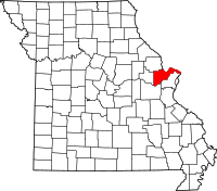
 Location in the U.S. state of Missouri |
|
 Missouri's location in the U.S. |
|
| Founded | October 1, 1812 |
| Named for | Charles Borromeo |
| Seat | St. Charles |
| Largest city | O'Fallon |
| Area | |
| • Total | 593 sq mi (1,536 km2) |
| • Land | 560 sq mi (1,450 km2) |
| • Water | 32 sq mi (83 km2), 5.4% |
| Population (est.) | |
| • (2015) | 385,590 |
| • Density | 667/sq mi (257.51/km²) |
| Congressional districts | 2nd, 3rd |
| Time zone | Central: UTC-6/-5 |
| Website | www |
| St. Charles County, Missouri | ||
|---|---|---|
| 2008 Republican primary in Missouri | ||
| John McCain | 14,705 (34.95%) | |
| Mike Huckabee | 9,185 (21.83%) | |
| Mitt Romney | 15,869 (37.72%) | |
| Ron Paul | 1,613 (3.83%) | |
| St. Charles County, Missouri | ||
|---|---|---|
| 2008 Democratic primary in Missouri | ||
| Hillary Clinton | 23,611 (50.14%) | |
| Barack Obama | 22,356 (47.48%) | |
| John Edwards (withdrawn) | 821 (1.74%) | |
St. Charles County is a county in the eastern part of the U.S. state of Missouri. As of the 2010 census, the population was 360,485, making it Missouri's third-most populous county. Its county seat is St. Charles. The county was organized October 1, 1812 and named for Saint Charles Borromeo, an Italian cardinal. The county executive is Steve Ehlmann, since January 2007.
St. Charles County is part of the St. Louis, MO-IL Metropolitan Statistical Area and contains many of the city's northern suburbs.
The wealthiest county in Missouri, St. Charles County is one of the nation's fastest-growing counties. The county is also recognized as very conservative, ranking in the top 100 nationally, and many residents support a gun culture.
St. Charles County includes an area of vineyards and wineries whose distinction has been nationally recognized. On its rural outer edge along the south-facing bluffs above the Missouri River is an area of numerous wineries, so that Missouri Route 94 is sometimes called the Missouri Weinstrasse. The area includes the Augusta AVA, designated in 1980 as the first American Viticultural Area by the federal government.
The County of St. Charles was originally called the District of St. Charles and had no definite limits until 1816 to 1818 when neighboring counties were formed. The borders of St. Charles are the same today as they were in 1818.
According to the U.S. Census Bureau, the county has a total area of 593 square miles (1,540 km2), of which 560 square miles (1,500 km2) is land and 32 square miles (83 km2) (5.4%) is water.
...
Wikipedia
