St. Louis Place
| St. Louis Place | |
|---|---|
| St. Louis neighborhood | |

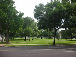
A park in St. Louis Place neighborhood.
|
|
 Location of St. Louis Place within St. Louis |
|
| Country | United States |
| State | Missouri |
| City | St. Louis |
| Wards | 3, 5 |
| Government | |
| • Aldermen | |
| Area | |
| • Total | 0.69 sq mi (1.8 km2) |
| Population (2010) | |
| • Total | 2,939 |
| • Density | 4,300/sq mi (1,600/km2) |
| ZIP code(s) | Parts of 63106, 63107 |
| Area code(s) | 314 |
| Website | stlouis-mo.gov |
St. Louis Place is a neighborhood of St. Louis, Missouri. It is bounded by Palm Street on the North, Cass Avenue on the South, North Florissant on the East, and North Jefferson on the West.
In 2010 St. Louis Place's racial makeup was 91.7% Black, 7.1% White, 0.2% Native American, 0.3% Asian, 1.9% Two or More Races, and 0.3% Some Other Race. 0.6% of the population was of Hispanic or Latino origin.
Coordinates: 38°39′00″N 90°12′21″W / 38.6501°N 90.2059°W
...
Wikipedia
