St Croix, U.S. Virgin Islands

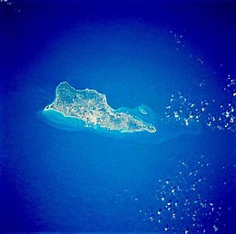
Saint Croix from space, January 1992
|
|
| Geography | |
|---|---|
| Location | Caribbean Sea |
| Coordinates | 17°44′23″N 64°44′20″W / 17.73972°N 64.73889°WCoordinates: 17°44′23″N 64°44′20″W / 17.73972°N 64.73889°W |
| Archipelago | Virgin Islands, Leeward Islands |
| Area | 82 sq mi (210 km2) |
| Length | 22 mi (35 km) |
| Width | 7 mi (11 km) |
| Highest elevation | 1,165 ft (355.1 m) |
| Highest point | Mount Eagle |
| Administration | |
| Territory | Virgin Islands |
| District | District of Saint Croix |
| Demographics | |
| Demonym | Crucian |
| Population | 50,601 (2010) |
| Pop. density | 610 /sq mi (236 /km2) |
| Ethnic groups | Afro-Caribbean, Puerto Rican, Caucasian |
Saint Croix (/ˌseɪnt ˈkrɔɪ/; Spanish: Santa Cruz; Dutch: Sint-Kruis; French: Sainte-Croix; Danish and Norwegian: Sankt Croix, Taino: Ay Ay) is an island in the Caribbean Sea, and a county and constituent district of the United States Virgin Islands (USVI), an unincorporated territory of the United States.
St. Croix is the largest of the islands in the territory. However, the territory's capital, Charlotte Amalie, is located on Saint Thomas. As of the 2010 United States Census, St. Croix's population was 50,601, its highest point is Mount Eagle, at 355 metres (1,165 ft).
The island was inhabited by various indigenous groups during its prehistory. Christopher Columbus landed on Santa Cruz, as he called it, on November 14, 1493, and immediately was attacked by the Kalinago, who lived at Salt River on the north shore. This is the first recorded fight between the Spanish and a New World native population, and Columbus gave the battle site the name Cabo de la Flecha (Cape of the Arrow). The Spanish never colonized the Islands, but most or all of the native population was eventually dispersed or killed. By the end of the 16th century, the islands were said to be uninhabited.
...
Wikipedia


