Stadtkyll
| Stadtkyll | ||
|---|---|---|
|
||
| Coordinates: 50°21′08″N 6°31′52″E / 50.35222°N 6.53111°ECoordinates: 50°21′08″N 6°31′52″E / 50.35222°N 6.53111°E | ||
| Country | Germany | |
| State | Rhineland-Palatinate | |
| District | Vulkaneifel | |
| Municipal assoc. | Obere Kyll | |
| Government | ||
| • Mayor | Harald Schmitz | |
| Area | ||
| • Total | 20.78 km2 (8.02 sq mi) | |
| Elevation | 450 m (1,480 ft) | |
| Population (2015-12-31) | ||
| • Total | 1,520 | |
| • Density | 73/km2 (190/sq mi) | |
| Time zone | CET/CEST (UTC+1/+2) | |
| Postal codes | 54589 | |
| Dialling codes | 06597 | |
| Vehicle registration | DAU | |
| Website | www.stadtkyll.de | |
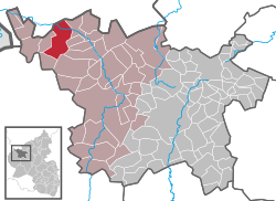
Stadtkyll is an Ortsgemeinde – a municipality belonging to a Verbandsgemeinde, a kind of collective municipality – in the Vulkaneifel district in Rhineland-Palatinate, Germany. It belongs to the Verbandsgemeinde of Obere Kyll, whose seat is in the municipality of Jünkerath. Stadtkyll is a state-recognized climatic spa (Luftkurort).
The municipality lies in the Vulkaneifel, a part of the Eifel known for its volcanic history, geographical and geological features, and even ongoing activity today, including gases that sometimes well up from the earth. Stadtkyll lies on the river Kyll.
Stadtkyll’s Ortsteile are Niederkyll, Schönfeld and Stadtkyll.
Near the village and in the outlying centre of Niederkyll, many finds from Roman times have been unearthed during excavation work. In the lists of the Archiepiscopal Cathedraticum, which come from about 1100, is a mention of the village under the name Kyll. In the 13th century, the village quickly grew in importance. About 1250 it was raised to town and thereby also acquired the right to bear a coat of arms; the one borne then matches the one borne today. In 1292, it had already become a town girded with a wall and with a castle. In 1308, it had its first documentary mention as Stadtkyll-Opidum in the Liber valoris. Over the course of its history, Stadtkyll has been beset by several catastrophes. In 1632, in the Thirty Years' War, an army of mercenaries set most of the village on fire. In 1687, the French destroyed the village. In 1814 and again in 1854, great fires burnt Stadtkyll down. After these fires, the old town wall served as a quarry of sorts for building material to rebuild the village. The wall completely disappeared as a result, and its alignment can now only be made out in the rows of houses on Burgbergstraße.
...
Wikipedia


