Star Prairie, Wisconsin
| Star Prairie, Wisconsin | |
|---|---|
| Village | |
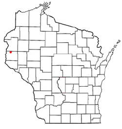
 Location of Star Prairie, Wisconsin |
|
| Coordinates: 45°10′3″N 92°35′13″W / 45.16750°N 92.58694°WCoordinates: 45°10′3″N 92°35′13″W / 45.16750°N 92.58694°W | |
| Country | United States |
| State | Wisconsin |
| County | St. Croix |
| Area | |
| • Total | 2.16 sq mi (5.59 km2) |
| • Land | 2.16 sq mi (5.59 km2) |
| • Water | 0 sq mi (0 km2) |
| Elevation | 879 ft (268 m) |
| Population (2010) | |
| • Total | 561 |
| • Estimate (2012) | 559 |
| • Density | 259.7/sq mi (100.3/km2) |
| Time zone | Central (CST) (UTC-6) |
| • Summer (DST) | CDT (UTC-5) |
| Area code(s) | 715 & 534 |
| FIPS code | 55-76850 |
| GNIS feature ID | 1584215 |
| Website | villageofstarprairie |
Star Prairie is a village in St. Croix County in the U.S. state of Wisconsin. The population was 561 at the 2010 census. The village is located along the Apple River on the boundary between the Town of Star Prairie and the Town of Stanton.
Star Prairie is located at 45°11′53″N 92°31′55″W / 45.19806°N 92.53194°W (45.198274, -92.531987).
According to the United States Census Bureau, the village has a total area of 2.16 square miles (5.59 km2), all of it land. The Apple River flows through the center of town, where it is joined by a small stream called Saratoga Spring.
As of the census of 2010, there were 561 people, 230 households, and 155 families residing in the village. The population density was 259.7 inhabitants per square mile (100.3/km2). There were 248 housing units at an average density of 114.8 per square mile (44.3/km2). The racial makeup of the village was 96.6% White, 1.4% Native American, 0.9% Asian, and 1.1% from two or more races. Hispanic or Latino of any race were 1.6% of the population.
...
Wikipedia
