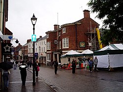
Stone, Staffordshire
| Stone | |
|---|---|
 Stone High Street |
|
| Stone shown within Staffordshire | |
| Population | 16,385 (2011 census) |
| OS grid reference | SJ902342 |
| District | |
| Shire county | |
| Region | |
| Country | England |
| Sovereign state | United Kingdom |
| Post town | STONE |
| Postcode district | ST15 |
| Dialling code | 01785 |
| Police | Staffordshire |
| Fire | Staffordshire |
| Ambulance | West Midlands |
| EU Parliament | West Midlands |
| UK Parliament | |
Stone is an old market town in Staffordshire, England, situated about 7 miles (11 km) north of Stafford, and around 7 miles (11 km) south of the city of Stoke-on-Trent. It is the second town, after Stafford itself, in the Borough of Stafford, and has long been of importance from the point of view of communications. Stone gave its name to both an urban district council and a rural district council before becoming part of the borough in 1974.
Stone is a growing town, according to the national Census. Stone recorded a population of 12,305 in 1991, 14,555 in 2001, and 16,385 in 2011.
There is a Bronze Age ring ditch at Pirehill suggesting occupation in prehistoric times (County Archeology).
Stone lies within the territory of the Iron Age Celtic tribe 'the cornovii' (people of the horn; perhaps a horned god or topographical feature) mentioned by Ptolemy 2nd century AD in Geographia. To the northwest of Stone lies one of their hill forts which overlooks the Trent and perhaps the salt production in the region.
The early history of Stone is unclear and clouded by the 12th century medieval romance concerning the murder of the Saxon princes Wulfad and Rufin by their father Wulfhere of Mercia who reputedly had his base near Darleston (Wulfherecester). The murder of Wulfad in the 7th century and his subsequent entombment under a cairn of stones is the traditional story (described as 'historically valueless' by Thacker 1985: 6).
More recent research points to older, though no less interesting nor tangible, possibilities regarding its name and founding. Around Stone lie several Romano British sites and it is not inconceivable that the stone remains of a bridge or milestone, perhaps continuing the Roman road from Rocester to Blyth Bridge and then potentially through Stone, is alluded to in the name. The settlement of Walton (which now forms a suburb) is ancient Brythonic (Celtic/ancient Briton place name). The most likely derivation for most places called Stone is from a prehistoric megalith, Roman milestone, a natural boulder or rock formation, or from 'a place where stone was obtained' (see JEPNS 3 1970-1 13), and a Keuper sandstone outcrop on the north side of Stone, long quarried for building materials, may be the topographical feature from which the place was named. It may also be noted that a huge stone or erratic is recorded on Common Plot (JNSFC 1897-8 XXXII 165), and in that respect it is unclear whether Stone Field here, one of the open-fields of Stone (Stone Field 1665 SRO D327215/21/1-9,1798 Act; see also StEnc 556) is 'the field at Stone' or 'the field with the stone'. (Horovitz,D.2003.Nottingham University. A Survey of the Place Names of Staffordshire)
...
Wikipedia

