Tecumseh, Oklahoma
| Tecumseh, Oklahoma | |
|---|---|
| City | |

Tecumseh City Hall, December 2016
|
|
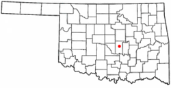
 Location of Tecumseh, Oklahoma |
|
| Coordinates: 35°15′44″N 96°56′5″W / 35.26222°N 96.93472°WCoordinates: 35°15′44″N 96°56′5″W / 35.26222°N 96.93472°W | |
| Country | United States |
| State | Oklahoma |
| County | Pottawatomie |
| Government | |
| • Type | Council-Manager |
| • City Council | Lou Sutterfield, Ward 1 Jimmy Jordan, Ward 2 Linda Praytor, Ward 3 Willis Faye Motley, Ward 4 |
| Area | |
| • Total | 15.3 sq mi (39.6 km2) |
| • Land | 15.0 sq mi (39.0 km2) |
| • Water | 0.2 sq mi (0.6 km2) |
| Elevation | 1,083 ft (330 m) |
| Population (2010) | |
| • Total | 6,457 |
| • Density | 406/sq mi (156.6/km2) |
| Time zone | Central (CST) (UTC-6) |
| • Summer (DST) | CDT (UTC-5) |
| ZIP code | 74873 |
| Area code(s) | 405 |
| FIPS code | 40-72650 |
| GNIS feature ID | 1098783 |
| Website | http://www.tecumsehok.com |
Tecumseh is a city in Pottawatomie County, Oklahoma, United States. The population was 6,457 at the 2010 census, a 5.9 percent increase from 6,098 at the 2000 census. It was named for the noted Shawnee chief, Tecumseh, and was designated as the county seat at Oklahoma's statehood. A county-wide election moved the seat to Shawnee in 1930.
A 320-acre site was opened for settlement September 23, 1891, as a result of the land run into reservations of the Sac and Fox, Iowa, Kickapoo, Shawnee and Potawatomi peoples. The townsite, named Tecumseh by a U.S. Army Major, had been designated as the seat of County "B" in the newly formed Oklahoma Territory by the Department of the Interior on July 17, 1891. A post office was established in the town on September 18, 1891.
In 1903 the Atchison, Topeka and Santa Fe Railway began serving Tecumseh's surrounding agricultural region, in which cotton was the main crop. Cotton production dropped in the 1920s because of depressed prices and a boll weevil infestation. The population dropped after 1930, because many townspeople moved away to earn a living elsewhere.
Tecumseh is located at 35°15′44″N 96°56′5″W / 35.26222°N 96.93472°W (35.262346, -96.934830).
According to the United States Census Bureau, the city has a total area of 15.3 square miles (40 km2), of which, 15.0 square miles (39 km2) of it is land and 0.2 square miles (0.52 km2) of it (1.57%) is water.
As of the census of 2000, there were 6,098 people, 2,344 households, and 1,654 families residing in the city. The population density was 405.5 people per square mile (156.5/km²). There were 2,565 housing units at an average density of 170.6 per square mile (65.8/km²). The racial makeup of the city was 78.98% White, 2.05% African American, 12.87% Native American, 0.18% Asian, 0.02% Pacific Islander, 0.46% from other races, and 5.44% from two or more races. Hispanic or Latino of any race were 1.77% of the population.
...
Wikipedia
