Tippah County, MS
| Tippah County, Mississippi | |
|---|---|

The Tippah County courthouse in Ripley
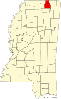
|
|
 Location in the U.S. state of Mississippi |
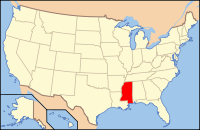
|
 Mississippi's location in the U.S. |
|
| Founded | 1836 |
| Seat | Ripley |
| Largest city | Ripley |
| Area | |
| • Total | 460 sq mi (1,191 km2) |
| • Land | 458 sq mi (1,186 km2) |
| • Water | 2.1 sq mi (5 km2), 0.5% |
| Population | |
| • (2010) | 22,232 |
| • Density | 49/sq mi (19/km²) |
| Congressional district | 1st |
| Time zone | Central: UTC-6/-5 |
Tippah County is a county located on the northern border of the U.S. state of Mississippi. As of the 2010 census, the population was 22,232. Its county seat is Ripley. The name "Tippah" is derived from a Chickasaw language word meaning "cut off." It was taken from the creek of the same name that flows across much of the original county from northeast to southwest before emptying into the Tallahatchie River. The creek probably was so named because it, and the ridges on either side, "cut off" the western part of the region from the eastern portion.
One of former President Bill Clinton's great-grandfathers is buried here.
According to the U.S. Census Bureau, the county has a total area of 460 square miles (1,200 km2), of which 458 square miles (1,190 km2) is land and 2.1 square miles (5.4 km2) (0.5%) is water.
At the 2000 census, there are 20,826 people, 8,108 households and 5,910 families residing in the county. The population density was 46 per square mile (18/km²). There were 8,868 housing units at an average density of 19 per square mile (7/km²). The racial makeup of the county was 81.85% White, 15.92% Black or African American, 0.20% Native American, 0.11% Asian, 0.01% Pacific Islander, 1.29% from other races, and 0.61% from two or more races. 2.08% of the population were Hispanic or Latino of any race.
...
Wikipedia
