Tishomingo County, Mississippi
| Tishomingo County, Mississippi | |
|---|---|

Tishomingo County Courthouse
|
|
 Location in the U.S. state of Mississippi |
|
 Mississippi's location in the U.S. |
|
| Founded | February 9, 1836 |
| Named for | Chief Tishomingo |
| Seat | Iuka |
| Largest city | Iuka |
| Area | |
| • Total | 445 sq mi (1,153 km2) |
| • Land | 424 sq mi (1,098 km2) |
| • Water | 20 sq mi (52 km2), 4.6% |
| Population | |
| • (2010) | 19,593 |
| • Density | 46/sq mi (18/km²) |
| Congressional district | 1st |
| Time zone | Central: UTC-6/-5 |
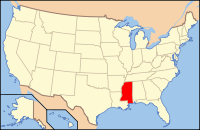
Tishomingo County is a county located in the northeast corner of the U.S. state of Mississippi. As of the 2010 census, the population was 19,593. Its county seat is Iuka.
Tishomingo County was organized February 9, 1836, from Chickasaw lands that were ceded to the United States. The Chickasaw were forced by Indian Removal to relocate to lands in the Indian Territory (now Oklahoma). In 1870 this land was divided into Alcorn, Prentiss and Tishomingo counties.
Tishomingo was referred to in the Coen brothers' film, O Brother, Where Art Thou?.
According to the U.S. Census Bureau, the county has a total area of 445 square miles (1,150 km2), of which 424 square miles (1,100 km2) is land and 20 square miles (52 km2) (4.6%) is water. The highest natural point in Mississippi, the 806 feet (246 meter) Woodall Mountain, is located in the county. Tishomingo County is the only county in Mississippi with outcroppings of natural limestone formations.
...
Wikipedia

