Troutdale, Virginia
| Troutdale, Virginia | |
|---|---|
| Town | |
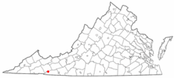
 Location of Troutdale, Virginia |
|
| Coordinates: 36°42′3″N 81°26′41″W / 36.70083°N 81.44472°WCoordinates: 36°42′3″N 81°26′41″W / 36.70083°N 81.44472°W | |
| Country | United States |
| State | Virginia |
| County | Grayson |
| Area | |
| • Total | 3.1 sq mi (8.1 km2) |
| • Land | 3.1 sq mi (8.1 km2) |
| • Water | 0.0 sq mi (0.0 km2) |
| Elevation | 3,127 ft (953 m) |
| Population (2010) | |
| • Total | 178 |
| Time zone | Eastern (EST) (UTC-5) |
| • Summer (DST) | EDT (UTC-4) |
| ZIP code | 24378 |
| Area code(s) | 276 |
| FIPS code | 51-79456 |
| GNIS feature ID | 2391451 |
Troutdale is a town in Grayson County, Virginia, United States. The population was 178 at the 2010 census.
Troutdale is located at 36°42′3″N 81°26′41″W / 36.70083°N 81.44472°W (36.700963, -81.444823).
According to the United States Census Bureau, the town has a total area of 3.1 square miles (8.1 km²), all land.
The climate in this area has mild differences between highs and lows, and there is adequate rainfall year round. According to the Köppen Climate Classification system, Troutdale has a marine west coast climate, abbreviated "Cfb" on climate maps.
Troutdale was chartered as a town by the Virginia Legislature in 1906 and remains an incorporated town with a council and mayor. The Troutdale town limit is a circle of 1 mile radius. In 1930, Carrie Wright was elected as mayor, possibly the first female mayor in Virginia.
The original 2000 census listed Troutdale with a population of 1,230, a very sharp increase from 192 in 1990. This, and the similarly anomalous figure of 30.89% African-American population, was the result of a tabulation error in which much of the population of nearby Wise County's correctional facilities were counted as Troutdale residents. census revision
...
Wikipedia
