U.S. Highway 79
| U.S. Route 79 | |
|---|---|
 |
|
| Route information | |
| Length: | 855 mi (1,376 km) |
| Existed: | 1935 – present |
| Major junctions | |
| South end: |
|
|
|
|
| North end: |
|
| Location | |
| States: | Texas, Louisiana, Arkansas, Tennessee, Kentucky |
| Highway system | |
![]() I-45 in Buffalo, TX
I-45 in Buffalo, TX![]() I-20 in Shreveport, LA
I-20 in Shreveport, LA![]() I-55 in West Memphis, AR
I-55 in West Memphis, AR![]() I-40 in Memphis, TN
I-40 in Memphis, TN
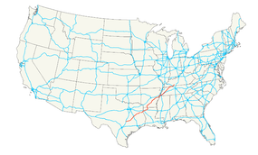
U.S. Route 79 (US 79) is a United States highway. The route is officially considered and labeled as a north-south highway, but it actually more of diagonal northeast-southwest highway. The highway's northern/eastern terminus is in Russellville, Kentucky, at an intersection with U.S. Highway 68 and KY 80. Its southern/western terminus is in Round Rock, Texas, at an intersection with Interstate 35, ten miles (16 km) north of Austin.
...
Wikipedia

