Union County, MS
| Union County, Mississippi | |
|---|---|

The Union County courthouse in New Albany
|
|
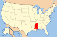
 Location in the U.S. state of Mississippi |
|
 Mississippi's location in the U.S. |
|
| Founded | 1870 |
| Seat | New Albany |
| Largest city | New Albany |
| Area | |
| • Total | 417 sq mi (1,080 km2) |
| • Land | 416 sq mi (1,077 km2) |
| • Water | 1.3 sq mi (3 km2), 0.3% |
| Population | |
| • (2010) | 27,134 |
| • Density | 65/sq mi (25/km²) |
| Congressional district | 1st |
| Time zone | Central: UTC-6/-5 |
Union County is a county located in the U.S. state of Mississippi. As of the 2010 census, the population was 27,134. Its county seat is New Albany. According to most sources, the county received its name by being a union of pieces of several large counties, like other Union counties in other states. However, other sources say that the name was meant to mark the re-union of Mississippi and the other Confederate states after the Civil War (at the time, the state had a Republican government under Reconstruction) or that the name came from the Union District, South Carolina, where many of the area's first European-American settlers came from. It is possible that there was more than one reason for the name.
According to the U.S. Census Bureau, the county has a total area of 417 square miles (1,080 km2), of which 416 square miles (1,080 km2) is land and 1.3 square miles (3.4 km2) (0.3%) is water.
As of the census of 2000, there were 25,362 people, 9,786 households, and 7,241 families residing in the county. The population density was 61 people per square mile (24/km²). There were 10,693 housing units at an average density of 26 per square mile (10/km²). The racial makeup of the county was 83.42% White, 14.95% Black or African American, 0.13% Native American, 0.20% Asian, 0.02% Pacific Islander, 0.67% from other races, and 0.62% from two or more races. 1.63% of the population were Hispanic or Latino of any race.
...
Wikipedia
