Vale of Aylesbury
| Aylesbury Vale District | |
|---|---|
| Non-metropolitan district | |

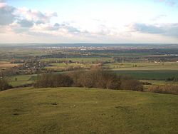
Part of Aylesbury Vale taken from the top of Coombe Hill, looking towards Aylesbury
|
|
 Aylesbury Vale shown within Buckinghamshire |
|
| Sovereign state | United Kingdom |
| Constituent country | England |
| Region | South East England |
| Non-metropolitan county | Buckinghamshire |
| Status | Non-metropolitan district |
| Admin HQ | Aylesbury |
| Incorporated | 1 April 1974 |
| Government | |
| • Type | Non-metropolitan district council |
| • Body | Aylesbury Vale District Council |
| • Leadership | Leader & Cabinet (Conservative) |
| • MPs |
John Bercow (Speaker) David Lidington (Conservative) |
| Area | |
| • Total | 348.55 sq mi (902.75 km2) |
| Area rank | 36th (of 326) |
| Population (mid-2015 est.) | |
| • Total | 188,700 |
| • Rank | 93rd (of 326) |
| • Density | 540/sq mi (210/km2) |
| • Ethnicity | 92.3% White 3.7% S.Asian 1.5% Black 1.5% Mixed 1.0% Chinese or Other |
| Time zone | GMT (UTC0) |
| • Summer (DST) | BST (UTC+1) |
| ONS code | 11UB (ONS) E07000004 (GSS) |
| OS grid reference | SP818138 |
| Website | www |
The Aylesbury Vale (or Vale of Aylesbury) is a large area of gently rolling agricultural landscape located in the northern half of Buckinghamshire, England. Its boundary is marked by Milton Keynes to the north, Leighton Buzzard and the Chiltern Hills to the east and south, Thame to the south and Bicester and Brackley to the west.
The vale is named after Aylesbury, the county town of Buckinghamshire. Two other towns lie within the vale and they are Winslow and Buckingham.
The bed of the vale is largely made up of clay that was formed at the end of the ice age. Also at this time the vast underground reserves of water that make the water table in the Vale of Aylesbury higher than average, were created.
In the 2001 UK census the population of Aylesbury Vale was 165,748, representing an increase since 1991 of 18,600 people. About half of those live in the county town Aylesbury.
Aylesbury Vale is a local government district of northern Buckinghamshire, administered by a district council. The district was formed on 1 April 1974 by the merger of the boroughs of Aylesbury and Buckingham, Aylesbury Rural District, Buckingham Rural District, Wing Rural District and part of Winslow Rural District. The district offices are based in Aylesbury. The district council's logo includes the historical figure of John Hampden.
...
Wikipedia
