Vila Nova de Poiares Municipality
| Vila Nova de Poiares | |||
|---|---|---|---|
| Municipality | |||
|
|||
 |
|||
| Coordinates: 40°12′39″N 8°15′27″W / 40.21083°N 8.25750°WCoordinates: 40°12′39″N 8°15′27″W / 40.21083°N 8.25750°W | |||
| Country |
|
||
| Region | Centro | ||
| Subregion | Pinhal Interior Norte | ||
| Intermunic. comm. | Região de Coimbra | ||
| District | Coimbra | ||
| Parishes | 4 | ||
| Area | |||
| • Total | 84.45 km2 (32.61 sq mi) | ||
| Population (2011) | |||
| • Total | 7,281 | ||
| • Density | 86/km2 (220/sq mi) | ||
| Time zone | WET/WEST (UTC+0/+1) | ||
| Website | web |
||
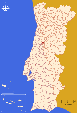
Vila Nova de Poiares (Portuguese pronunciation: [ˈvilɐ ˈnɔvɐ ðɨ poˈjaɾɨʃ]) is a municipality in the Coimbra district, in Portugal. The population in 2011 was 7,281, in an area of 84.45 km².
Administratively, the municipality is divided into 4 civil parishes (freguesias):
Vila Nova de Poiares is twinned with:
...
Wikipedia


