Watkinsville, Georgia
| Watkinsville, Georgia | |
|---|---|
| Town | |

Oconee County Courthouse in Watkinsville, Georgia
|
|
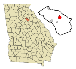
 Location in Oconee County and the state of Georgia |
|
| Coordinates: 33°51′46″N 83°24′29″W / 33.86278°N 83.40806°WCoordinates: 33°51′46″N 83°24′29″W / 33.86278°N 83.40806°W | |
| Country | United States |
| State | Georgia |
| County | Oconee |
| Government | |
| • Post 5 Councilman | Dan Matthews |
| Area | |
| • Total | 3.2 sq mi (8.3 km2) |
| • Land | 3.2 sq mi (8.3 km2) |
| • Water | 0 sq mi (0 km2) |
| Elevation | 719 ft (219 m) |
| Population (2010) | |
| • Total | 2,832 |
| • Density | 655.3/sq mi (252.7/km2) |
| Time zone | Eastern (EST) (UTC-5) |
| • Summer (DST) | EDT (UTC-4) |
| ZIP code | 30677 |
| Area code(s) | 706 |
| FIPS code | 13-80788 |
| GNIS feature ID | 0333373 |
| Website | http://cityofwatkinsville.com/ |
Watkinsville is the largest city and seat of Oconee County, Georgia, United States. As of the 2010 census, the town had a total population of 2,832. It had previously been the seat of Clarke County until 1872 when the county seat of that county was moved to Athens, a move which ultimately led to the creation of Oconee County in 1875. It is included in the Athens-Clarke County, Georgia Metropolitan Statistical Area.
Watkinsville is located at 33°51′46″N 83°24′29″W / 33.86278°N 83.40806°W (33.862818, -83.408094).
According to the United States Census Bureau, the town has a total area of 3.2 square miles (8.3 km2), of which, 3.2 square miles (8.3 km2) of it is land and 0.31% is water.
As of the census of 2000, there were 2,097 people, 827 households, and 578 families residing in the town. The population density was 650.6 people per square mile (251.4/km²). There were 862 housing units at an average density of 267.4 per square mile (103.4/km²). The racial makeup of the town was 89.08% White, 7.34% African American, 0.05% Native American, 1.62% Asian, 0.48% Pacific Islander, 0.86% from other races, and 0.57% from two or more races. Hispanic or Latino of any race were 1.96% of the population.
...
Wikipedia
