West Drayton
| West Drayton | |
|---|---|
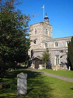
 St Martin's church |
|
| West Drayton shown within Greater London | |
| Population | 14,370 (2011) |
| OS grid reference | TQ065795 |
| • Charing Cross | 14.8 mi (23.8 km) E |
| London borough | |
| Ceremonial county | Greater London |
| Region | |
| Country | England |
| Sovereign state | United Kingdom |
| Post town | WEST DRAYTON |
| Postcode district | UB7 |
| Dialling code | 01895 |
| Police | Metropolitan |
| Fire | London |
| Ambulance | London |
| EU Parliament | London |
| UK Parliament | |
| London Assembly | |
West Drayton is a suburban town in the London Borough of Hillingdon, England. Formerly part of the Yiewsley and West Drayton Urban District of Middlesex, the district became part of Greater London in 1965.
The population was recorded as 14,370 in the 2011 Census.
The London Borough of Hillingdon is split by the Great Western Railway and the Grand Union Canal, both of which run east-west. West Drayton is generally south of this divide and Yiewsley to the north. It is situated just north of junction 4 of the M4 motorway (Heathrow Airport spur), which intersects with the A408 (for Stockley Business Park), north for Uxbridge, and it terminates south at Heathrow Airport itself. The nearby A3044 goes through Harmondsworth to the south.
West Drayton railway station provides rail links on the First Great Western service from Paddington station in London to Reading and Bristol. There is a primary school. The local secondary school is on Falling Lane. The former Evelyns Community School was demolished in order to make way for the Academy.
West Drayton also incorporates a conservation area, The Green. Around The Green are a number of listed buildings, both residential and commercial.
...
Wikipedia

